Area Overview for HG1 4EB
Photos of HG1 4EB
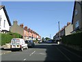
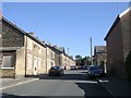
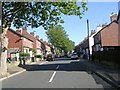
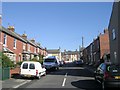
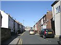
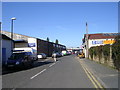
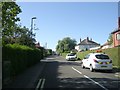
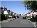
100 photos from this area
Area Information
Key information about the HG1 4EB including its size, population, and administrative classification.
- Area Type
- Postcode
- Area Size
- 16.2 hectares
- Population
- 1739
- Population Density
- 2097 people/km²
House Prices in HG1 4EB
29
Properties
£340,091
Average Sold Price
£150,000
Lowest Price
£621,325
Highest Price
Showing 29 properties
| Address | Type | Beds | Baths | Last Sale Price | Last Sale Date | |
|---|---|---|---|---|---|---|
| Carwood, 45 Bogs Lane, Harrogate, HG1 4EB | Detached | 4 | 2 | £485,000 | Jan 2024 | |
| 55 Bogs Lane, Harrogate, HG1 4EB | Detached | 5 | 3 | £621,325 | Aug 2023 | |
| 58 Bogs Lane, Harrogate, HG1 4EB | Detached | 3 | 2 | £278,000 | Jun 2021 | |
| 48 Bogs Lane, Harrogate, HG1 4EB | Bungalow | 3 | 1 | £325,000 | May 2020 | |
| The Birches, 50 Bogs Lane, Harrogate, HG1 4EB | Bungalow | 5 | 3 | £335,000 | Oct 2019 | |
| 62 Bogs Lane, Harrogate, HG1 4EB | Semi-detached | 2 | 1 | £550,000 | Jul 2019 | |
| 51 Bogs Lane, Harrogate, HG1 4EB | Detached | 4 | 2 | £440,000 | May 2016 | |
| 42 Bogs Lane, Harrogate, HG1 4EB | Semi-detached | 3 | 3 | £295,000 | Oct 2014 | |
| 36 Bogs Lane, Harrogate, HG1 4EB | Bungalow | 2 | - | £240,000 | May 2014 | |
| 60 Bogs Lane, Harrogate, HG1 4EB | Bungalow | - | - | £150,000 | Sep 2010 |
Page 1 of 3
Energy Efficiency in HG1 4EB
Amenities
Schools
| Rank | School | Type | Entry gender | Ages |
|---|
Explore more schools in this area
Go to Schools tabDemographics
Household Size
Two person
most common
Accommodation Type
Houses
most common
Tenure
70
majority
Ethnic Group
White
most common
Religion
N/A
most common
Household Composition
N/A
most common
Age
47
median
Adults (30-64 years)
most common
Household Deprivation
N/A
with no deprivation
NS-SEC
38
in Lower managerial occupations
Explore more demographic insights in this area
Go to Demographics tabPlanning
Planning Constraints
- Flood RiskPremium
- Ramsar Wetland SitesPremium
- Area of Outstanding Natural BeautyPremium
- Protected Nature ReservePremium
- Protected WoodlandPremium