Area Overview for HG1 2LB
Photos of HG1 2LB

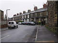
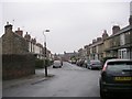
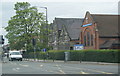
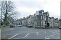
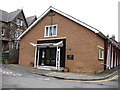
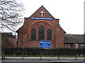
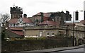
100 photos from this area
Area Information
Key information about the HG1 2LB including its size, population, and administrative classification.
- Area Type
- Postcode
- Area Size
- 3241 m²
- Population
- 1422
- Population Density
- 4475 people/km²
House Prices in HG1 2LB
20
Properties
£155,188
Average Sold Price
£115,000
Lowest Price
£180,000
Highest Price
Showing 20 properties
| Address | Type | Beds | Baths | Last Sale Price | Last Sale Date | |
|---|---|---|---|---|---|---|
| 14 Coppice Beck Court, Harrogate, HG1 2LB | Flat | 2 | 1 | £169,000 | Sep 2022 | |
| 2 Coppice Beck Court, Harrogate, HG1 2LB | Flat | 2 | 1 | £170,000 | Mar 2022 | |
| 6 Coppice Beck Court, Harrogate, HG1 2LB | Flat | - | - | £166,500 | Feb 2022 | |
| 16 Coppice Beck Court, Harrogate, HG1 2LB | Flat | - | - | £159,950 | Nov 2021 | |
| 18 Coppice Beck Court, Harrogate, HG1 2LB | Flat | 2 | 1 | £165,000 | Apr 2021 | |
| 7 Coppice Beck Court, Harrogate, HG1 2LB | Flat | 2 | 1 | £160,000 | Nov 2020 | |
| 1 Coppice Beck Court, Harrogate, HG1 2LB | Flat | - | - | £180,000 | Oct 2020 | |
| 9 Coppice Beck Court, Harrogate, HG1 2LB | Flat | 2 | 1 | £177,000 | Jun 2019 | |
| 8 Coppice Beck Court, Harrogate, HG1 2LB | Flat | 2 | - | £174,000 | Nov 2018 | |
| 17 Coppice Beck Court, Harrogate, HG1 2LB | Flat | - | - | £142,500 | Mar 2018 |
Page 1 of 2
Energy Efficiency in HG1 2LB
Amenities
Schools
| Rank | School | Type | Entry gender | Ages |
|---|
Explore more schools in this area
Go to Schools tabDemographics
Household Size
One person
most common
Accommodation Type
Flats
most common
Tenure
55
majority
Ethnic Group
White
most common
Religion
N/A
most common
Household Composition
N/A
most common
Age
47
median
Adults (30-64 years)
most common
Household Deprivation
N/A
with no deprivation
NS-SEC
47
in Lower managerial occupations
Explore more demographic insights in this area
Go to Demographics tabPlanning
Planning Constraints
- Flood RiskPremium
- Ramsar Wetland SitesPremium
- Area of Outstanding Natural BeautyPremium
- Protected Nature ReservePremium
- Protected WoodlandPremium