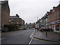
Area Overview for HG1 1SQ
Photos of HG1 1SQ


Area Information
HG1 1SQ is a small residential postcode in England with a population of 1511, forming a compact cluster of homes. The area is defined by its proximity to key transport links and retail hubs, making it practical for daily life. Residents benefit from nearby rail stations, including Harrogate and Starbeck, which connect to broader networks. The community is predominantly composed of adults aged 30–64, with a median age of 47, suggesting a mature, stable demographic. While the area’s size is limited, it offers access to essential services such as supermarkets and high-speed broadband, ensuring modern connectivity. Living here balances residential tranquillity with practical access to amenities, though the small footprint means the local environment is tightly integrated with surrounding areas. The absence of major natural constraints, such as protected woodlands or flood-prone zones, adds to its appeal for those prioritising safety and ease of access. For buyers, HG1 1SQ represents a focused, community-oriented postcode where proximity to infrastructure and a defined demographic profile shape the local character.
- Area Type
- Postcode
- Area Size
- Not available
- Population
- 1511
- Population Density
- 3646 people/km²
The property market in HG1 1SQ is characterised by a 64% home ownership rate, with flats being the predominant accommodation type. This suggests a housing stock focused on multi-unit developments, likely catering to families and older adults. The area’s small size means the market is limited in scale, with fewer options for buyers compared to larger towns or cities. The high proportion of flats may indicate a rental market component, though the exact split between owner-occupied and rental properties is not specified. For buyers, this means the available stock is likely to be concentrated in purpose-built flats, which may appeal to those seeking low-maintenance living or proximity to transport links. The lack of larger properties, such as detached homes, suggests the area is not ideal for those prioritising spacious, traditional housing. However, the compact nature of HG1 1SQ could make it a strategic choice for investors or buyers seeking a specific location with established infrastructure.
House Prices in HG1 1SQ
No properties found in this postcode.
Energy Efficiency in HG1 1SQ
Residents of HG1 1SQ have access to a range of nearby amenities, including five retail outlets such as Sainsburys Harrogate, Tesco Cambridge, and M&S Harrogate. These stores provide convenience for daily shopping, from groceries to clothing. The area’s rail stations—Harrogate, Hornbeam Park, and Starbeck—offer direct links to larger towns and cities, facilitating both leisure and work-related travel. While the data does not mention parks or leisure facilities, the proximity to retail and transport hubs suggests a lifestyle focused on practicality and accessibility. The presence of multiple rail stations also implies a community that values connectivity, making it easier to access cultural or recreational opportunities beyond the immediate area. For buyers, this means HG1 1SQ offers a balance of convenience and integration with surrounding regions, though the local environment itself may lack expansive green spaces or dedicated leisure amenities.
Amenities
Schools
| Rank | School | Type | Entry gender | Ages |
|---|
Explore more schools in this area
Go to Schools tabDemographics
The population of HG1 1SQ is 1511, with a median age of 47, reflecting a mature community. The most common age range is adults aged 30–64, indicating a demographic skewed towards middle-aged and older residents. Home ownership rates are 64%, suggesting a mix of owner-occupied properties and rental units. The primary accommodation type is flats, which aligns with the area’s compact residential layout. The predominant ethnic group is White, though no specific data on other groups is provided. This age profile and housing stock imply a settled, low-turnover community with established residents. The absence of detailed diversity metrics means the area’s social composition remains largely homogenous. For buyers, this demographic profile suggests a focus on stability and long-term residency, with housing needs tailored to older adults and families. The 64% home ownership rate also indicates a balance between private and rental markets, though the exact proportion of renters is not specified.
Household Size
Accommodation Type
Tenure
Ethnic Group
Religion
Household Composition
Age
Household Deprivation
NS-SEC
Explore more demographic insights in this area
Go to Demographics tabPlanning
Planning Constraints
- Flood RiskPremium
- Ramsar Wetland SitesPremium
- Area of Outstanding Natural BeautyPremium
- Protected Nature ReservePremium
- Protected WoodlandPremium