Area Overview for HG1 1EG
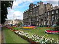
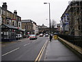
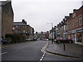
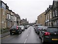
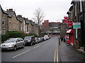
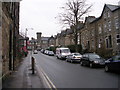
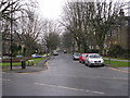
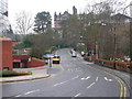
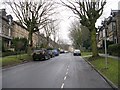
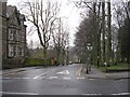
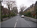
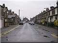
Photos of HG1 1EG
Area Information
HG1 1EG is a compact residential postcode in England, covering just 5,426 square metres and home to 1,759 residents. Its high population density of 324,183 people per square kilometre reflects a tightly knit community, where proximity to local amenities and transport links shapes daily life. The area’s small footprint means residents are likely to find essential services within walking distance. With a mix of retail outlets, including Waitrose and Sainsburys, and multiple railway stations, the area balances urban convenience with residential tranquillity. The presence of primary schools and a language academy suggests a focus on education, appealing to families. While the population is relatively small, the area’s connectivity and amenities create a self-contained environment, ideal for those prioritising accessibility over expansive space.
- Area Type
- Postcode
- Area Size
- 5426 m²
- Population
- 1759
- Population Density
- 5053 people/km²
HG1 1EG is a rental-dominated area, with only 23% of residents owning their homes. The accommodation is primarily flats, which is typical for smaller, high-density postcode areas. This suggests a limited supply of owner-occupied properties, making it challenging for buyers seeking a long-term investment. The focus on flats may appeal to those prioritising convenience over space, particularly given the area’s proximity to transport and amenities. However, the small size of the area means the housing stock is unlikely to cater to larger families or those requiring more spacious living. Buyers should consider the market’s rental orientation and the potential for competition among buyers seeking limited owner-occupied options.
House Prices in HG1 1EG
No properties found in this postcode.
Energy Efficiency in HG1 1EG
Living in HG1 1EG offers access to a range of amenities within walking distance or a short drive. Retail options include major supermarkets like Waitrose, Sainsburys, and Cook Harrogate, supporting everyday shopping needs. The proximity to five railway stations, such as Harrogate and Hornbeam Park, enhances connectivity, facilitating travel to nearby towns and cities. While the area lacks extensive parks or leisure facilities, its compact size ensures that essential services are readily available. The presence of schools and retail hubs contributes to a convenient, community-focused lifestyle, ideal for those prioritising accessibility over expansive recreational spaces.
Amenities
Schools
Residents of HG1 1EG have access to three schools within practical reach. St Peter’s Church of England Primary School and Harrogate, St Peter’s Church of England Primary School cater to younger children, offering primary education. The Harrogate Language Academy provides additional educational options, possibly for older students or language-specific curricula. The presence of two primary schools suggests a strong focus on early education, though the absence of secondary schools may require families to travel further for secondary education. The mix of school types indicates a range of educational opportunities, though the data does not specify Ofsted ratings or academic performance.
| Rank | School | Type | Entry gender | Ages |
|---|
Explore more schools in this area
Go to Schools tabDemographics
The community in HG1 1EG is predominantly composed of adults aged 30–64, with a median age of 47. This suggests a mature, stable population, likely with established careers and family structures. Home ownership is low at 23%, indicating that the area is more rental-focused, with flats making up the majority of accommodation. The predominant ethnic group is White, reflecting a homogenous demographic profile. The high proportion of working-age adults may contribute to a quiet, low-traffic environment, though the lack of data on deprivation means it is unclear how this affects access to services. The age range and housing type suggest a community centred on long-term residency rather than transient populations.
Household Size
Accommodation Type
Tenure
Ethnic Group
Religion
Household Composition
Age
Household Deprivation
NS-SEC
Explore more demographic insights in this area
Go to Demographics tabPlanning
Planning Constraints
- Flood RiskPremium
- Ramsar Wetland SitesPremium
- Area of Outstanding Natural BeautyPremium
- Protected Nature ReservePremium
- Protected WoodlandPremium