Area Overview for HG1 1EF
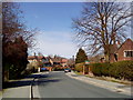
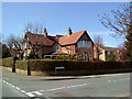
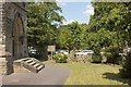
Photos of HG1 1EF


Area Information
HG1 1EF is a small, tightly knit residential cluster in England, home to 1,759 residents. The area’s compact nature fosters a quiet, community-oriented lifestyle, with a population skewed toward adults aged 30–64. This suggests a mature demographic, likely drawn to the area’s stability and proximity to local amenities. While the postcode covers a limited geographic footprint, it is well-served by nearby retail hubs, railway stations, and essential services. Daily life here balances practicality with accessibility, with residents able to reach major shopping centres like Waitrose Harrogate and Sainsburys Harrogate within short distances. The area’s small size means it is not a sprawling suburb but a focused residential pocket, ideal for those seeking a low-key, manageable living environment. Its location near Harrogate’s transport network also offers connections to broader regional routes, though the community itself remains distinct and self-contained. For buyers, HG1 1EF presents a niche opportunity to invest in a specific, well-defined postcode with clear boundaries and a defined character.
- Area Type
- Postcode
- Area Size
- Not available
- Population
- 1759
- Population Density
- 5053 people/km²
The property market in HG1 1EF is characterised by a low home ownership rate of 23%, indicating that the majority of housing is rented rather than owner-occupied. This suggests a rental market with limited opportunities for long-term investment in property ownership. The accommodation type is predominantly flats, which may reflect a mix of purpose-built residential blocks or conversions of older buildings. Given the area’s small size and the prevalence of flats, the housing stock is likely limited in both quantity and variety. Buyers considering this postcode may find the available properties constrained by the area’s compact nature, necessitating a broader search beyond HG1 1EF for more options. The low home ownership rate also implies that the area may attract tenants seeking short-term or flexible housing solutions, rather than those prioritising property investment.
House Prices in HG1 1EF
No properties found in this postcode.
Energy Efficiency in HG1 1EF
Residents of HG1 1EF benefit from nearby retail and dining options, including major supermarkets such as Cook Harrogate, Waitrose Harrogate, and Sainsburys Harrogate. These stores provide convenient access to groceries, household essentials, and other retail services. The area’s proximity to multiple railway stations, such as Harrogate Railway Station, enhances its connectivity, allowing residents to reach broader destinations with ease. While there is no mention of parks or leisure facilities in the data, the presence of retail hubs and transport links suggests a lifestyle that prioritises practicality and accessibility. The compact nature of the area means that daily errands and social activities can be managed within a short radius, contributing to a self-contained, efficient living environment.
Amenities
Schools
Residents of HG1 1EF have access to three schools within practical reach. These include St Peter’s Church of England Primary School, a primary school, and Harrogate Language Academy, which is categorised as an "other" type of educational institution. A second St Peter’s Church of England Primary School is also listed, though it may be a duplicate or a separate campus. The presence of two primary schools suggests that families with young children have options for early education, though the "other" category school’s specific focus or curriculum is not detailed. The mix of primary schools and the Harrogate Language Academy could indicate a range of educational approaches, from traditional state schooling to language-focused or specialist provision. However, without Ofsted ratings or further details on the schools’ performance, prospective families should conduct additional research to assess quality.
| Rank | School | Type | Entry gender | Ages |
|---|
Explore more schools in this area
Go to Schools tabDemographics
The population of HG1 1EF is predominantly adults aged 30–64, with a median age of 47. This indicates a mature, established community, likely with a strong presence of middle-aged professionals and families. Home ownership in the area is relatively low at 23%, suggesting that a significant proportion of residents are renters, possibly due to the area’s small size and limited housing stock. The accommodation type is primarily flats, which aligns with the low home ownership rate and may reflect a mix of purpose-built housing or converted properties. The predominant ethnic group is White, though no further breakdown of diversity is provided. The absence of specific data on deprivation or socioeconomic status means this aspect of quality of life cannot be assessed from the available information. The demographic profile suggests a stable, perhaps middle-income community with a focus on practical living over luxury.
Household Size
Accommodation Type
Tenure
Ethnic Group
Religion
Household Composition
Age
Household Deprivation
NS-SEC
Explore more demographic insights in this area
Go to Demographics tabPlanning
Planning Constraints
- Flood RiskPremium
- Ramsar Wetland SitesPremium
- Area of Outstanding Natural BeautyPremium
- Protected Nature ReservePremium
- Protected WoodlandPremium