Area Overview for Heaton Ward
Photos of Heaton Ward

Area Information
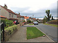
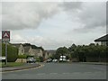
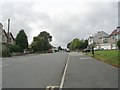
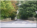
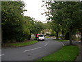
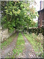
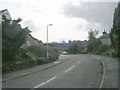
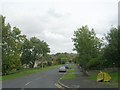
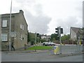
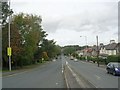
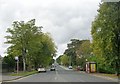
Heaton Ward functions as a compact electoral ward within the City of Bradford metropolitan borough. This district covers a small area of 5.5 km² in West Yorkshire, yet it houses a population of 5,519 residents. The location encompasses the distinct villages of Frizinghall, Heaton and Daisy Hill, creating a defined sense of place within the larger urban context. Historically, the name derives from an Anglo-Saxon term for a high farmstead, first appearing in records from 1160. Today, the community extends towards Chellow Heights Reservoir while retaining links to its agricultural roots under the BD16 postcode area. You will find that daily life here balances residential density with significant historical assets. The ward contains 32 listed buildings, anchored by heritage sites such as Heaton Hall and St Barnabas Church. Former Woolsorters' Gardens, established in the 1840s as pleasure grounds, now contribute to the local character. Unique landmarks include the former Police Station, built in 1876, which has been converted into a private residence. The geography also includes United College, originally opened in 1877 and later known as Airedale. Living in Heaton Ward means accessing a neighbourhood where history is physically present in the streets and buildings. The small footprint means the area feels intimate, with amenities closer to home compared to sprawling suburbs.
- Area Type
- District Borough Unitary Ward
- Area Size
- 5.5 km²
- Population
- 5519
- Population Density
- 995 people/km²
Demographics
The community profile of Heaton Ward reflects a settled population with a median age of 70. This age structure indicates that the majority of residents are senior citizens, shaping the local pace and amenities. The data shows home ownership stands at a substantial 63%, meaning the majority of households own their properties outright or with a mortgage. This high level of ownership contrasts with typical younger urban areas where renting is more common. The ward does not contain specific breakdowns for ethnicity or religion in the current statistics, but the demographic structure points to a stable, long-term residential base. Safety concerns exist regarding crime levels. You must accept that the Crime Risk assessment carries a WARNING status with a score of 53 out of 100. This places crime rates around the average for the region, suggesting that standard security precautions remain advisable for all residents. You cannot assume greater security than typical without taking active measures. The demographic reality demands that buyers understand the area is geared towards an older, settled population rather than young families or students. The household composition data is available but marked as total, requiring you to rely on the ownership figure to gauge the financial commitment of the area.
Household Size
Accommodation Type
Tenure
Ethnic Group
Religion
Household Composition
Age
Household Deprivation
NS-SEC
Explore more demographic insights in this area
Go to Demographics tabPlanning
Planning Constraints
- Flood RiskLocked
- Ramsar Wetland SitesLocked
- Area of Outstanding Natural BeautyLocked
- Protected Nature ReserveLocked
- Protected WoodlandLocked
- Crime RiskLocked