Area Overview for HD9 7JX
Photos of HD9 7JX
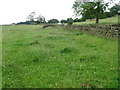

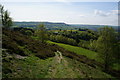
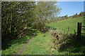

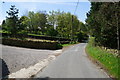
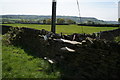
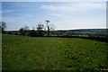
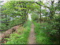
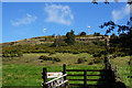
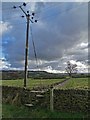

22 photos from this area
Area Information
Key information about the HD9 7JX including its size, population, and administrative classification.
- Area Type
- Postcode
- Area Size
- 23.2 hectares
- Population
- 1857
- Population Density
- 340 people/km²
House Prices in HD9 7JX
22
Properties
£554,628
Average Sold Price
£100,000
Lowest Price
£765,000
Highest Price
Showing 22 properties
| Address | Type | Beds | Baths | Last Sale Price | Last Sale Date | |
|---|---|---|---|---|---|---|
| Three Valleys, Cold Hill Lane, New Mill, Holmfirth, HD9 7JX | Detached | 4 | 2 | £735,000 | Jan 2025 | |
| Ash Tree Rise, Cold Hill Lane, New Mill, Holmfirth, HD9 7JX | Detached | 5 | 2 | £705,000 | May 2024 | |
| Stagwood Hill Farm, Cold Hill Lane, New Mill, Holmfirth, HD9 7JX | Detached | 5 | 3 | £600,000 | Oct 2023 | |
| Hillside, Cold Hill Lane, New Mill, Holmfirth, HD9 7JX | Bungalow | 2 | 1 | £570,000 | Aug 2022 | |
| Hawthorn Cottage, Cold Hill Lane, New Mill, Holmfirth, HD9 7JX | Detached | 5 | 4 | £600,000 | Mar 2021 | |
| Windyridge, Cold Hill Lane, New Mill, Holmfirth, HD9 7JX | house | - | - | £700,000 | Nov 2020 | |
| Hawthorn Mount, Cold Hill Lane, New Mill, Holmfirth, HD9 7JX | Detached | 5 | 4 | £574,788 | Oct 2020 | |
| Daisy Lea, Cold Hill Lane, New Mill, Holmfirth, HD9 7JX | Detached | 5 | 3 | £550,000 | May 2017 | |
| Bankfield, Cold Hill Lane, New Mill, Holmfirth, HD9 7JX | house | - | - | £535,000 | Mar 2017 | |
| 21 Cold Hill Lane, New Mill, Holmfirth, HD9 7JX | house | - | - | £364,000 | Dec 2016 |
Page 1 of 3
Energy Efficiency in HD9 7JX
Amenities
Schools
| Rank | School | Type | Entry gender | Ages |
|---|
Explore more schools in this area
Go to Schools tabDemographics
Household Size
Two person
most common
Accommodation Type
Houses
most common
Tenure
87
majority
Ethnic Group
White
most common
Religion
N/A
most common
Household Composition
N/A
most common
Age
47
median
Adults (30-64 years)
most common
Household Deprivation
N/A
with no deprivation
NS-SEC
47
in Lower managerial occupations
Explore more demographic insights in this area
Go to Demographics tabPlanning
Planning Constraints
- Flood RiskPremium
- Ramsar Wetland SitesPremium
- Area of Outstanding Natural BeautyPremium
- Protected Nature ReservePremium
- Protected WoodlandPremium