Area Overview for HD9 6LT
Photos of HD9 6LT

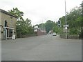
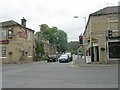
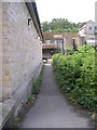
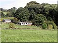
100 photos from this area
Area Information
Key information about the HD9 6LT including its size, population, and administrative classification.
- Area Type
- Postcode
- Area Size
- 5.4 hectares
- Population
- 2341
- Population Density
- 2496 people/km²
House Prices in HD9 6LT
22
Properties
£127,850
Average Sold Price
£28,500
Lowest Price
£190,000
Highest Price
Showing 22 properties
| Address | Type | Beds | Baths | Last Sale Price | Last Sale Date | |
|---|---|---|---|---|---|---|
| 54 Huddersfield Road, Honley, Holmfirth, HD9 6LT | Terraced | 4 | 1 | £190,000 | Sep 2025 | |
| 70 Huddersfield Road, Honley, Holmfirth, HD9 6LT | Terraced | 2 | 1 | £163,000 | Jun 2023 | |
| 78 Huddersfield Road, Honley, Holmfirth, HD9 6LT | Terraced | 2 | 1 | £145,000 | Oct 2022 | |
| 60 Huddersfield Road, Honley, Holmfirth, HD9 6LT | house | 3 | 1 | £149,950 | Jun 2022 | |
| 62 Huddersfield Road, Honley, Holmfirth, HD9 6LT | house | 3 | - | £140,000 | Feb 2021 | |
| 66 Huddersfield Road, Honley, Holmfirth, HD9 6LT | Terraced | 3 | 1 | £155,000 | Feb 2020 | |
| 64 Huddersfield Road, Honley, Holmfirth, HD9 6LT | Cottage | 2 | 1 | £108,500 | Oct 2019 | |
| 58 Huddersfield Road, Honley, Holmfirth, HD9 6LT | Terraced | 2 | 1 | £106,000 | Jan 2019 | |
| 56 Huddersfield Road, Honley, Holmfirth, HD9 6LT | house | 3 | - | £127,500 | Jun 2017 | |
| 80 Huddersfield Road, Honley, Holmfirth, HD9 6LT | Bungalow | 2 | 1 | £160,000 | Apr 2016 |
Page 1 of 3
Energy Efficiency in HD9 6LT
Amenities
Schools
| Rank | School | Type | Entry gender | Ages |
|---|
Explore more schools in this area
Go to Schools tabDemographics
Household Size
One person
most common
Accommodation Type
Houses
most common
Tenure
61
majority
Ethnic Group
White
most common
Religion
N/A
most common
Household Composition
N/A
most common
Age
47
median
Adults (30-64 years)
most common
Household Deprivation
N/A
with no deprivation
NS-SEC
37
in Lower managerial occupations
Explore more demographic insights in this area
Go to Demographics tabPlanning
Planning Constraints
- Flood RiskPremium
- Ramsar Wetland SitesPremium
- Area of Outstanding Natural BeautyPremium
- Protected Nature ReservePremium
- Protected WoodlandPremium