Area Overview for HD9 6AH
Photos of HD9 6AH
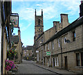
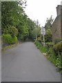
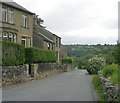
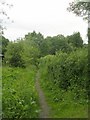
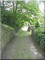
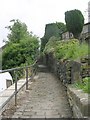
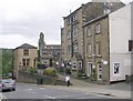
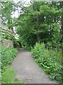
86 photos from this area
Area Information
Key information about the HD9 6AH including its size, population, and administrative classification.
- Area Type
- Postcode
- Area Size
- 4916 m²
- Population
- 2341
- Population Density
- 2496 people/km²
House Prices in HD9 6AH
20
Properties
£149,330
Average Sold Price
£88,503
Lowest Price
£240,000
Highest Price
Showing 20 properties
| Address | Type | Beds | Baths | Last Sale Price | Last Sale Date | |
|---|---|---|---|---|---|---|
| 2 Church Street, Honley, Holmfirth, HD9 6AH | Terraced | 3 | 2 | £240,000 | Jun 2025 | |
| 23 Church Street, Honley, Holmfirth, HD9 6AH | house | - | - | £88,503 | Mar 2023 | |
| 24 Church Street, Honley, Holmfirth, HD9 6AH | Cottage | 2 | 1 | £145,000 | Nov 2021 | |
| 22 Church Street, Honley, Holmfirth, HD9 6AH | Cottage | 1 | - | £115,000 | Apr 2021 | |
| 35 Church Street, Honley, Holmfirth, HD9 6AH | Cottage | 2 | 1 | £172,500 | Nov 2020 | |
| 6 Church Street, Honley, Holmfirth, HD9 6AH | house | 2 | 1 | £115,000 | Aug 2019 | |
| 20 Church Street, Honley, Holmfirth, HD9 6AH | Terraced | 4 | - | £228,000 | May 2019 | |
| 17B Church Street, Honley, Holmfirth, HD9 6AH | Flat | - | - | £117,500 | Feb 2018 | |
| 33 Church Street, Honley, Holmfirth, HD9 6AH | Terraced | 3 | 1 | £143,000 | Mar 2016 | |
| 10 Church Street, Honley, Holmfirth, HD9 6AH | house | 3 | 2 | £160,000 | Mar 2016 |
Page 1 of 2
Energy Efficiency in HD9 6AH
Amenities
Schools
| Rank | School | Type | Entry gender | Ages |
|---|
Explore more schools in this area
Go to Schools tabDemographics
Household Size
One person
most common
Accommodation Type
Houses
most common
Tenure
61
majority
Ethnic Group
White
most common
Religion
N/A
most common
Household Composition
N/A
most common
Age
47
median
Adults (30-64 years)
most common
Household Deprivation
N/A
with no deprivation
NS-SEC
37
in Lower managerial occupations
Explore more demographic insights in this area
Go to Demographics tabPlanning
Planning Constraints
- Flood RiskPremium
- Ramsar Wetland SitesPremium
- Area of Outstanding Natural BeautyPremium
- Protected Nature ReservePremium
- Protected WoodlandPremium