Area Overview for HD9 5PG
Photos of HD9 5PG
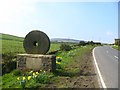

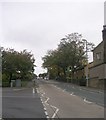
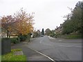
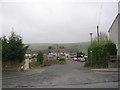
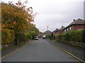
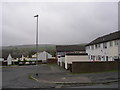
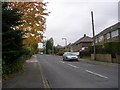
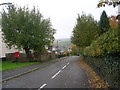
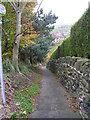
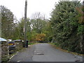
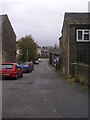
100 photos from this area
Area Information
Key information about the HD9 5PG including its size, population, and administrative classification.
- Area Type
- Postcode
- Area Size
- 1.5 hectares
- Population
- 1873
- Population Density
- 1698 people/km²
House Prices in HD9 5PG
19
Properties
£284,279
Average Sold Price
£30,000
Lowest Price
£630,000
Highest Price
Showing 19 properties
| Address | Type | Beds | Baths | Last Sale Price | Last Sale Date | |
|---|---|---|---|---|---|---|
| 55 Slaithwaite Road, Meltham, Holmfirth, HD9 5PG | Detached | 4 | 2 | £630,000 | Mar 2025 | |
| 20 Slaithwaite Road, Meltham, Holmfirth, HD9 5PG | Detached | 4 | 2 | £375,000 | Nov 2024 | |
| 32 Slaithwaite Road, Meltham, Holmfirth, HD9 5PG | Semi-detached | 3 | 1 | £280,000 | Aug 2023 | |
| 49 Slaithwaite Road, Meltham, Holmfirth, HD9 5PG | house | - | - | £421,000 | Dec 2021 | |
| 43 Slaithwaite Road, Meltham, Holmfirth, HD9 5PG | Semi-detached | 3 | - | £315,000 | Feb 2021 | |
| 53 Slaithwaite Road, Meltham, Holmfirth, HD9 5PG | Detached | 4 | 1 | £290,000 | Aug 2020 | |
| 56 Slaithwaite Road, Meltham, Holmfirth, HD9 5PG | house | 5 | 1 | £390,000 | Oct 2019 | |
| 24 Slaithwaite Road, Meltham, Holmfirth, HD9 5PG | Terraced | 5 | - | £315,000 | Apr 2018 | |
| 51 Slaithwaite Road, Meltham, Holmfirth, HD9 5PG | house | - | - | £330,000 | Dec 2016 | |
| 22 Slaithwaite Road, Meltham, Holmfirth, HD9 5PG | Terraced | 3 | 1 | £176,500 | Mar 2016 |
Page 1 of 2
Energy Efficiency in HD9 5PG
Amenities
Schools
| Rank | School | Type | Entry gender | Ages |
|---|
Explore more schools in this area
Go to Schools tabDemographics
Household Size
One person
most common
Accommodation Type
Houses
most common
Tenure
56
majority
Ethnic Group
White
most common
Religion
N/A
most common
Household Composition
N/A
most common
Age
47
median
Adults (30-64 years)
most common
Household Deprivation
N/A
with no deprivation
NS-SEC
31
in Lower managerial occupations
Explore more demographic insights in this area
Go to Demographics tabPlanning
Planning Constraints
- Flood RiskPremium
- Ramsar Wetland SitesPremium
- Area of Outstanding Natural BeautyPremium
- Protected Nature ReservePremium
- Protected WoodlandPremium