Area Overview for HD9 5NQ
Photos of HD9 5NQ
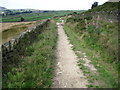
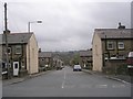
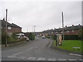
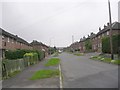
65 photos from this area
Area Information
Key information about the HD9 5NQ including its size, population, and administrative classification.
- Area Type
- Postcode
- Area Size
- 3.6 hectares
- Population
- 2027
- Population Density
- 170 people/km²
House Prices in HD9 5NQ
22
Properties
£231,785
Average Sold Price
£105,500
Lowest Price
£405,000
Highest Price
Showing 22 properties
| Address | Type | Beds | Baths | Last Sale Price | Last Sale Date | |
|---|---|---|---|---|---|---|
| 6 Kistvaen Gardens, Meltham, Holmfirth, HD9 5NQ | Detached | 4 | 2 | £405,000 | Aug 2024 | |
| 3 Kistvaen Gardens, Meltham, Holmfirth, HD9 5NQ | Detached | 3 | 2 | £245,000 | Mar 2019 | |
| 21 Kistvaen Gardens, Meltham, Holmfirth, HD9 5NQ | Cottage | 4 | - | £285,000 | Jul 2017 | |
| 14 Kistvaen Gardens, Meltham, Holmfirth, HD9 5NQ | house | 4 | - | £265,000 | Dec 2016 | |
| 17 Kistvaen Gardens, Meltham, Holmfirth, HD9 5NQ | house | - | - | £245,000 | Mar 2016 | |
| 7 Kistvaen Gardens, Meltham, Holmfirth, HD9 5NQ | Detached | 5 | - | £283,500 | Jan 2015 | |
| 16 Kistvaen Gardens, Meltham, Holmfirth, HD9 5NQ | Detached | - | - | £195,000 | Feb 2013 | |
| 19 Kistvaen Gardens, Meltham, Holmfirth, HD9 5NQ | house | - | - | £244,000 | Mar 2012 | |
| 25 Kistvaen Gardens, Meltham, Holmfirth, HD9 5NQ | house | - | - | £249,950 | Aug 2011 | |
| 15 Kistvaen Gardens, Meltham, Holmfirth, HD9 5NQ | Detached | 4 | 2 | £235,000 | Nov 2010 |
Page 1 of 3
Energy Efficiency in HD9 5NQ
Amenities
Schools
| Rank | School | Type | Entry gender | Ages |
|---|
Explore more schools in this area
Go to Schools tabDemographics
Household Size
Two person
most common
Accommodation Type
Houses
most common
Tenure
86
majority
Ethnic Group
White
most common
Religion
N/A
most common
Household Composition
N/A
most common
Age
47
median
Adults (30-64 years)
most common
Household Deprivation
N/A
with no deprivation
NS-SEC
44
in Lower managerial occupations
Explore more demographic insights in this area
Go to Demographics tabPlanning
Planning Constraints
- Flood RiskPremium
- Ramsar Wetland SitesPremium
- Area of Outstanding Natural BeautyPremium
- Protected Nature ReservePremium
- Protected WoodlandPremium