Area Overview for HD9 3UA
Photos of HD9 3UA
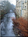
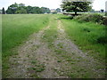
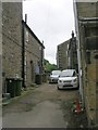
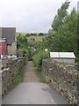
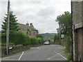
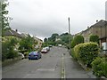
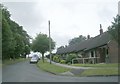
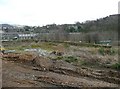
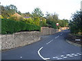
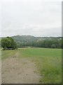
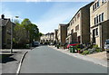
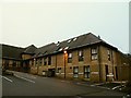
37 photos from this area
Area Information
Key information about the HD9 3UA including its size, population, and administrative classification.
- Area Type
- Postcode
- Area Size
- 1.2 hectares
- Population
- 1813
- Population Density
- 943 people/km²
House Prices in HD9 3UA
24
Properties
£183,676
Average Sold Price
£48,500
Lowest Price
£515,000
Highest Price
Showing 24 properties
| Address | Type | Beds | Baths | Last Sale Price | Last Sale Date | |
|---|---|---|---|---|---|---|
| 277 Huddersfield Road, Thongsbridge, Holmfirth, HD9 3UA | Terraced | 2 | 1 | £155,000 | Sep 2025 | |
| 295 Huddersfield Road, Thongsbridge, Holmfirth, HD9 3UA | Semi-detached | 3 | 1 | £160,000 | Feb 2025 | |
| 286 Huddersfield Road, Thongsbridge, Holmfirth, HD9 3UA | Terraced | 3 | 1 | £232,000 | May 2024 | |
| 303 Huddersfield Road, Thongsbridge, Holmfirth, HD9 3UA | Terraced | 4 | 2 | £450,000 | Jul 2023 | |
| 297 Huddersfield Road, Thongsbridge, Holmfirth, HD9 3UA | house | - | - | £250,000 | Nov 2020 | |
| 231 Huddersfield Road, Thongsbridge, Holmfirth, HD9 3UA | Detached | 5 | 3 | £515,000 | Aug 2020 | |
| 301 Huddersfield Road, Thongsbridge, Holmfirth, HD9 3UA | Terraced | 3 | - | £182,500 | Aug 2018 | |
| 284 Huddersfield Road, Thongsbridge, Holmfirth, HD9 3UA | Terraced | 5 | 3 | £164,000 | Sep 2017 | |
| 299 Huddersfield Road, Thongsbridge, Holmfirth, HD9 3UA | Terraced | 3 | 1 | £162,000 | Jul 2016 | |
| 279 Huddersfield Road, Thongsbridge, Holmfirth, HD9 3UA | Terraced | 3 | - | £118,500 | Sep 2014 |
Page 1 of 3
Energy Efficiency in HD9 3UA
Amenities
Schools
| Rank | School | Type | Entry gender | Ages |
|---|
Explore more schools in this area
Go to Schools tabDemographics
Household Size
Two person
most common
Accommodation Type
Houses
most common
Tenure
83
majority
Ethnic Group
White
most common
Religion
N/A
most common
Household Composition
N/A
most common
Age
47
median
Adults (30-64 years)
most common
Household Deprivation
N/A
with no deprivation
NS-SEC
46
in Lower managerial occupations
Explore more demographic insights in this area
Go to Demographics tabPlanning
Planning Constraints
- Flood RiskPremium
- Ramsar Wetland SitesPremium
- Area of Outstanding Natural BeautyPremium
- Protected Nature ReservePremium
- Protected WoodlandPremium