Area Overview for HD9 1JG
Photos of HD9 1JG
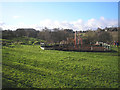
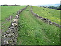
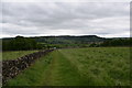
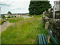
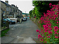
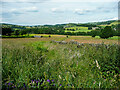
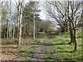
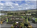
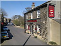
23 photos from this area
Area Information
Key information about the HD9 1JG including its size, population, and administrative classification.
- Area Type
- Postcode
- Area Size
- 4.0 hectares
- Population
- 1596
- Population Density
- 1424 people/km²
House Prices in HD9 1JG
10
Properties
£241,083
Average Sold Price
£130,000
Lowest Price
£410,000
Highest Price
Showing 10 properties
| Address | Type | Beds | Baths | Last Sale Price | Last Sale Date | |
|---|---|---|---|---|---|---|
| 10 Sike Lane, Totties, Holmfirth, HD9 1JG | Terraced | - | - | £315,000 | Mar 2025 | |
| 14 Sike Lane, Totties, Holmfirth, HD9 1JG | Terraced | 2 | 1 | £200,000 | Aug 2023 | |
| 1 Sike Lane, Totties, Holmfirth, HD9 1JG | Cottage | 2 | 1 | £260,000 | Sep 2022 | |
| 16 Sike Lane, Totties, Holmfirth, HD9 1JG | house | - | - | £243,750 | Nov 2019 | |
| The Barn, Sike Lane, Totties, Holmfirth, HD9 1JG | Semi-detached | 4 | 1 | £410,000 | Aug 2018 | |
| 5 Sike Lane, Totties, Holmfirth, HD9 1JG | Terraced | 1 | 1 | £157,000 | Mar 2018 | |
| 3 Sike Lane, Totties, Holmfirth, HD9 1JG | house | - | - | £130,000 | May 2015 | |
| 6-8 Sike Lane, Totties, Holmfirth, HD9 1JG | Terraced | - | - | £303,000 | Nov 2007 | |
| 18 Sike Lane, Totties, Holmfirth, HD9 1JG | house | - | - | £151,000 | May 2003 | |
| 12 Sike Lane, Totties, Holmfirth, HD9 1JG | Terraced | - | - | - | - |
Energy Efficiency in HD9 1JG
Amenities
Schools
| Rank | School | Type | Entry gender | Ages |
|---|
Explore more schools in this area
Go to Schools tabDemographics
Household Size
Two person
most common
Accommodation Type
Houses
most common
Tenure
79
majority
Ethnic Group
White
most common
Religion
N/A
most common
Household Composition
N/A
most common
Age
47
median
Adults (30-64 years)
most common
Household Deprivation
N/A
with no deprivation
NS-SEC
38
in Lower managerial occupations
Explore more demographic insights in this area
Go to Demographics tabPlanning
Planning Constraints
- Flood RiskPremium
- Ramsar Wetland SitesPremium
- Area of Outstanding Natural BeautyPremium
- Protected Nature ReservePremium
- Protected WoodlandPremium