Area Overview for HD8 9SU
Photos of HD8 9SU
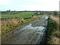
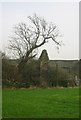
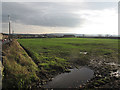
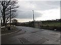
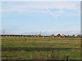
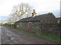

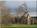
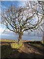
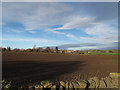
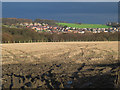
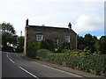
37 photos from this area
Area Information
Key information about the HD8 9SU including its size, population, and administrative classification.
- Area Type
- Postcode
- Area Size
- 60.5 hectares
- Population
- 1900
- Population Density
- 133 people/km²
House Prices in HD8 9SU
20
Properties
£394,164
Average Sold Price
£79,000
Lowest Price
£1,010,000
Highest Price
Showing 20 properties
| Address | Type | Beds | Baths | Last Sale Price | Last Sale Date | |
|---|---|---|---|---|---|---|
| Mouse House, Stringer House Lane, Emley Moor, Huddersfield, HD8 9SU | Cottage | 3 | - | £164,638 | Mar 2025 | |
| Wren Cottage, Stringer House Lane, Emley Moor, Huddersfield, HD8 9SU | house | - | - | £550,000 | Dec 2021 | |
| The Hollies, Stringer House Lane, Emley Moor, Huddersfield, HD8 9SU | Detached | 4 | 3 | £520,000 | Sep 2021 | |
| Lower Crawshaw, Stringer House Lane, Emley Moor, Huddersfield, HD8 9SU | house | - | - | £1,010,000 | Sep 2020 | |
| Stringer House Farm, 34 Stringer House Lane, Emley Moor, Huddersfield, HD8 9SU | Detached | 4 | 4 | £770,000 | Aug 2020 | |
| 1A Stringer House Lane, Emley Moor, Huddersfield, HD8 9SU | Detached | 4 | 2 | £440,000 | Aug 2020 | |
| 28 Stringer House Lane, Emley Moor, Huddersfield, HD8 9SU | Semi-detached | 2 | - | £130,000 | Aug 2016 | |
| 6 Stringer House Lane, Emley Moor, Huddersfield, HD8 9SU | Terraced | - | - | £79,000 | Sep 2003 | |
| Elmleigh Farm Cottage, 24 Stringer House Lane, Emley Moor, Huddersfield, HD8 9SU | Detached | 4 | 3 | £155,000 | May 2001 | |
| 4 Stringer House Lane, Emley Moor, Huddersfield, HD8 9SU | Terraced | - | - | £123,000 | Apr 2001 |
Page 1 of 2
Energy Efficiency in HD8 9SU
Amenities
Schools
| Rank | School | Type | Entry gender | Ages |
|---|
Explore more schools in this area
Go to Schools tabDemographics
Household Size
Two person
most common
Accommodation Type
Houses
most common
Tenure
80
majority
Ethnic Group
White
most common
Religion
N/A
most common
Household Composition
N/A
most common
Age
47
median
Adults (30-64 years)
most common
Household Deprivation
N/A
with no deprivation
NS-SEC
42
in Lower managerial occupations
Explore more demographic insights in this area
Go to Demographics tabPlanning
Planning Constraints
- Flood RiskPremium
- Ramsar Wetland SitesPremium
- Area of Outstanding Natural BeautyPremium
- Protected Nature ReservePremium
- Protected WoodlandPremium