Area Overview for HD8 8DB
Photos of HD8 8DB
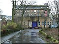
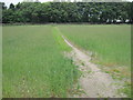
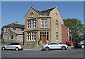

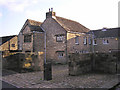
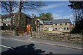
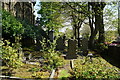
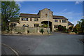
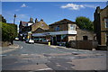
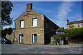
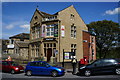
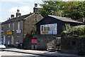
58 photos from this area
Area Information
Key information about the HD8 8DB including its size, population, and administrative classification.
- Area Type
- Postcode
- Area Size
- 11.4 hectares
- Population
- 1585
- Population Density
- 302 people/km²
House Prices in HD8 8DB
23
Properties
£244,496
Average Sold Price
£76,000
Lowest Price
£725,000
Highest Price
Showing 23 properties
| Address | Type | Beds | Baths | Last Sale Price | Last Sale Date | |
|---|---|---|---|---|---|---|
| 125 Lane Head Road, Shepley, Huddersfield, HD8 8DB | Terraced | 2 | 1 | £275,000 | Mar 2025 | |
| 132 Lane Head Road, Shepley, Huddersfield, HD8 8DB | house | - | - | £725,000 | Sep 2024 | |
| 99 Lane Head Road, Shepley, Huddersfield, HD8 8DB | Terraced | 3 | 1 | £265,000 | Sep 2023 | |
| 123 Lane Head Road, Shepley, Huddersfield, HD8 8DB | house | 3 | 1 | £270,000 | Mar 2022 | |
| 113 Lane Head Road, Shepley, Huddersfield, HD8 8DB | Terraced | 2 | - | £140,000 | Jun 2021 | |
| 115 Lane Head Road, Shepley, Huddersfield, HD8 8DB | Terraced | 1 | 1 | £137,500 | Jul 2020 | |
| 127 Lane Head Road, Shepley, Huddersfield, HD8 8DB | Cottage | 2 | 1 | £129,500 | Mar 2020 | |
| 93 Lane Head Road, Shepley, Huddersfield, HD8 8DB | Detached | 3 | 2 | £140,000 | Nov 2013 | |
| 121 Lane Head Road, Shepley, Huddersfield, HD8 8DB | Detached | - | - | £125,000 | Nov 2011 | |
| Wentworth House, 93A Lane Head Road, Shepley, Huddersfield, HD8 8DB | Detached | 3 | - | £389,950 | Dec 2010 |
Page 1 of 3
Energy Efficiency in HD8 8DB
Amenities
Schools
| Rank | School | Type | Entry gender | Ages |
|---|
Explore more schools in this area
Go to Schools tabDemographics
Household Size
Two person
most common
Accommodation Type
Houses
most common
Tenure
86
majority
Ethnic Group
White
most common
Religion
N/A
most common
Household Composition
N/A
most common
Age
47
median
Adults (30-64 years)
most common
Household Deprivation
N/A
with no deprivation
NS-SEC
46
in Lower managerial occupations
Explore more demographic insights in this area
Go to Demographics tabPlanning
Planning Constraints
- Flood RiskPremium
- Ramsar Wetland SitesPremium
- Area of Outstanding Natural BeautyPremium
- Protected Nature ReservePremium
- Protected WoodlandPremium