Area Overview for HD8 0QR
Photos of HD8 0QR
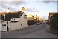
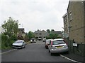
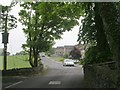
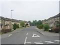
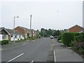
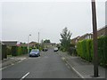
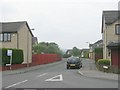
100 photos from this area
Area Information
Key information about the HD8 0QR including its size, population, and administrative classification.
- Area Type
- Postcode
- Area Size
- 3.8 hectares
- Population
- 1945
- Population Density
- 2192 people/km²
House Prices in HD8 0QR
71
Properties
£5,233,034
Average Sold Price
£48,951
Lowest Price
£109,686,257
Highest Price
Showing 71 properties
| Address | Type | Beds | Baths | Last Sale Price | Last Sale Date | |
|---|---|---|---|---|---|---|
| 15 Burton Acres Lane, Highburton, Huddersfield, HD8 0QR | Semi-detached | 3 | 1 | £225,000 | May 2025 | |
| 118 Burton Acres Lane, Kirkburton, Huddersfield, HD8 0QR | house | 4 | 3 | £447,500 | May 2025 | |
| 14 Burton Acres Lane, Highburton, Huddersfield, HD8 0QR | Semi-detached | 3 | 1 | £347,000 | Aug 2024 | |
| 4 Burton Acres Lane, Highburton, Huddersfield, HD8 0QR | Detached | 2 | 2 | £252,500 | Mar 2024 | |
| 1 Burton Acres Lane, Highburton, Huddersfield, HD8 0QR | Detached | 4 | 2 | £260,000 | Jun 2023 | |
| 92 Burton Acres Lane, Highburton, Huddersfield, HD8 0QR | Detached | 4 | 2 | £425,000 | Aug 2022 | |
| 84 Burton Acres Lane, Highburton, Huddersfield, HD8 0QR | Retail | 4 | 1 | £452,000 | Jun 2022 | |
| 26 Burton Acres Lane, Highburton, Huddersfield, HD8 0QR | Detached | 5 | 1 | £465,000 | Mar 2022 | |
| 1B Burton Acres Lane, Highburton, Huddersfield, HD8 0QR | Semi-detached | 3 | 2 | £250,000 | Sep 2021 | |
| 20 Burton Acres Lane, Highburton, Huddersfield, HD8 0QR | house | - | - | £717,500 | Feb 2021 |
Page 1 of 8
Energy Efficiency in HD8 0QR
Amenities
Schools
| Rank | School | Type | Entry gender | Ages |
|---|
Explore more schools in this area
Go to Schools tabDemographics
Household Size
Family (3-5 people)
most common
Accommodation Type
Houses
most common
Tenure
87
majority
Ethnic Group
White
most common
Religion
N/A
most common
Household Composition
N/A
most common
Age
47
median
Adults (30-64 years)
most common
Household Deprivation
N/A
with no deprivation
NS-SEC
45
in Lower managerial occupations
Explore more demographic insights in this area
Go to Demographics tabPlanning
Planning Constraints
- Flood RiskPremium
- Ramsar Wetland SitesPremium
- Area of Outstanding Natural BeautyPremium
- Protected Nature ReservePremium
- Protected WoodlandPremium