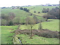
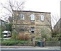
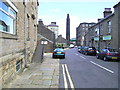
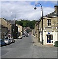
Area Overview for HD7 5JY
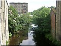
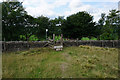
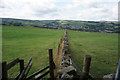
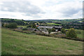
Photos of HD7 5JY


Area Information
HD7 5JY is a small residential postcode area in England with a population of 1554, reflecting a compact, closely knit community. The area is defined by its modest size and the presence of family-oriented housing, with a median age of 47 and a majority of residents aged 30–64. This suggests a mature, stable population, many of whom are likely to be long-term residents. Daily life in HD7 5JY is shaped by its proximity to essential services, including nearby schools, retail outlets, and rail connections. The area’s character is rooted in its practicality, with homes primarily in the form of detached or semi-detached properties. While it lacks large-scale amenities, its accessibility to nearby towns and natural features makes it a viable choice for those seeking a quieter, community-focused lifestyle. The absence of significant environmental constraints or flood risks adds to its appeal, though residents should remain mindful of the moderate crime risk. For buyers, HD7 5JY offers a snapshot of a traditional English suburb, where the pace of life is slower and local connections are strong.
- Area Type
- Postcode
- Area Size
- Not available
- Population
- 1554
- Population Density
- 2823 people/km²
The property market in HD7 5JY is dominated by owner-occupied homes, with 62% of residents living in properties they own. This contrasts with rental markets where private landlords predominate, indicating a community where long-term residency is common. The accommodation type is primarily houses, which are more prevalent than flats or apartments. This suggests a housing stock that caters to families and individuals seeking space and privacy, though the small size of the postcode area means the number of available properties is limited. Buyers should consider the immediate surroundings for a broader range of options, as the area itself is unlikely to have a large inventory. The high home ownership rate also implies that properties may be less frequently available, requiring buyers to act quickly when opportunities arise. For those prioritising a traditional, low-density living environment, HD7 5JY offers a niche but viable market.
House Prices in HD7 5JY
No properties found in this postcode.
Energy Efficiency in HD7 5JY
The lifestyle in HD7 5JY is shaped by its proximity to retail and transport hubs. The area has five retail outlets, including Aldi Slaithwaite, Co-op Slaithwaite, and Co-op Golcar, providing access to everyday shopping needs. These stores offer a range of products, from groceries to household goods, ensuring residents can meet daily requirements without traveling far. The rail network adds to the area’s convenience, with five stations offering connections to nearby towns and cities. While the data does not mention parks or leisure facilities, the presence of rail links and retail options suggests a practical, community-focused lifestyle. For those who enjoy walking or cycling, the small postcode area may offer limited green spaces, but the surrounding region likely provides more extensive recreational opportunities. The combination of retail access and transport connectivity makes HD7 5JY suitable for those prioritising convenience over large-scale amenities.
Amenities
Schools
Residents of HD7 5JY have access to two notable educational institutions: Nields Junior Infant and Nursery School, a primary school, and Nields Academy, an academy. Both are within practical reach, ensuring families can access early years education and secondary schooling without significant travel. The presence of a primary school suggests the area supports young families, while the academy may offer broader curricular options or specialist facilities. However, the data does not specify Ofsted ratings or academic performance, so prospective buyers should conduct further research on school quality. The combination of a primary and secondary institution within the area reduces the need for long commutes, which is a key consideration for parents. For families prioritising proximity to education, HD7 5JY’s school network is a tangible advantage, though the absence of detailed performance metrics means buyers must rely on local recommendations or official reports.
| Rank | School | Type | Entry gender | Ages |
|---|
Explore more schools in this area
Go to Schools tabDemographics
The population of HD7 5JY is predominantly adults aged 30–64, with a median age of 47. This indicates a community skewed towards middle-aged individuals, likely including families and professionals in their peak earning years. Home ownership is high, with 62% of residents living in owner-occupied properties, suggesting a stable housing market and long-term residency. The area is characterised by houses rather than flats, reflecting a preference for standalone or semi-detached dwellings. The predominant ethnic group is White, with no data provided on other demographics. The absence of specific information on deprivation or diversity means the area’s social fabric is not extensively detailed, but the high home ownership rate and age profile imply a relatively affluent, settled population. For buyers, this suggests a community with a focus on family living and property investment, though the lack of diversity data may limit understanding of broader social dynamics.
Household Size
Accommodation Type
Tenure
Ethnic Group
Religion
Household Composition
Age
Household Deprivation
NS-SEC
Explore more demographic insights in this area
Go to Demographics tabPlanning
Planning Constraints
- Flood RiskPremium
- Ramsar Wetland SitesPremium
- Area of Outstanding Natural BeautyPremium
- Protected Nature ReservePremium
- Protected WoodlandPremium