Area Overview for HD7 5FD
Photos of HD7 5FD
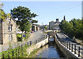
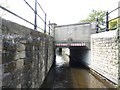
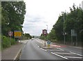
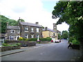
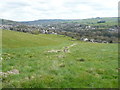
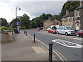
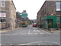

100 photos from this area
Area Information
Key information about the HD7 5FD including its size, population, and administrative classification.
- Area Type
- Postcode
- Area Size
- 5568 m²
- Population
- 1673
- Population Density
- 138 people/km²
House Prices in HD7 5FD
24
Properties
£267,771
Average Sold Price
£150,000
Lowest Price
£475,000
Highest Price
Showing 24 properties
| Address | Type | Beds | Baths | Last Sale Price | Last Sale Date | |
|---|---|---|---|---|---|---|
| 34 Empire Way, Slaithwaite, Huddersfield, HD7 5FD | Flat | - | - | £220,000 | May 2023 | |
| 10 Empire Way, Slaithwaite, Huddersfield, HD7 5FD | Retail | 3 | 1 | £370,000 | Oct 2022 | |
| 30 Empire Way, Slaithwaite, Huddersfield, HD7 5FD | Flat | - | - | £153,000 | Jun 2021 | |
| 22 Empire Way, Slaithwaite, Huddersfield, HD7 5FD | house | - | - | £377,500 | Feb 2021 | |
| 24 Empire Way, Slaithwaite, Huddersfield, HD7 5FD | house | - | - | £390,000 | Dec 2020 | |
| 32 Empire Way, Slaithwaite, Huddersfield, HD7 5FD | Flat | 2 | 1 | £160,000 | Nov 2020 | |
| 2 Empire Way, Slaithwaite, Huddersfield, HD7 5FD | house | - | - | £287,500 | Oct 2020 | |
| 18 Empire Way, Slaithwaite, Huddersfield, HD7 5FD | house | - | - | £475,000 | Sep 2020 | |
| 38 Empire Way, Slaithwaite, Huddersfield, HD7 5FD | Flat | - | - | £165,000 | Jul 2020 | |
| 36 Empire Way, Slaithwaite, Huddersfield, HD7 5FD | Flat | - | - | £162,500 | Jun 2020 |
Page 1 of 3
Energy Efficiency in HD7 5FD
Amenities
Schools
| Rank | School | Type | Entry gender | Ages |
|---|
Explore more schools in this area
Go to Schools tabDemographics
Household Size
Two person
most common
Accommodation Type
Houses
most common
Tenure
84
majority
Ethnic Group
White
most common
Religion
N/A
most common
Household Composition
N/A
most common
Age
47
median
Adults (30-64 years)
most common
Household Deprivation
N/A
with no deprivation
NS-SEC
45
in Lower managerial occupations
Explore more demographic insights in this area
Go to Demographics tabPlanning
Planning Constraints
- Flood RiskPremium
- Ramsar Wetland SitesPremium
- Area of Outstanding Natural BeautyPremium
- Protected Nature ReservePremium
- Protected WoodlandPremium