Area Overview for HD7 4PT
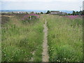
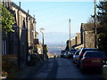
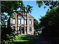
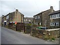
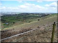
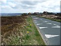
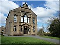
Photos of HD7 4PT
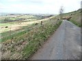
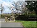
![Milestone [from the west], Longwood Common in HD7 4PT](https://images.propbar.co.uk/images/geograph/44/50/4450810_120.jpg)
![Milestone [from the east], Longwood Common in HD7 4PT](https://images.propbar.co.uk/images/geograph/44/50/4450817_120.jpg)
93 photos from this area
Area Information
Key information about the HD7 4PT including its size, population, and administrative classification.
- Area Type
- Postcode
- Area Size
- 5536 m²
- Population
- 1497
- Population Density
- 430 people/km²
House Prices in HD7 4PT
5
Properties
£335,980
Average Sold Price
£249,950
Lowest Price
£425,000
Highest Price
Showing 5 properties
| Address | Type | Beds | Baths | Last Sale Price | Last Sale Date | |
|---|---|---|---|---|---|---|
| 1 Royal Acre, Scapegoat Hill, Huddersfield, HD7 4PT | Detached | 4 | 2 | £425,000 | Mar 2019 | |
| 2 Royal Acre, Scapegoat Hill, Huddersfield, HD7 4PT | Detached | - | - | £310,000 | May 2010 | |
| 5 Royal Acre, Scapegoat Hill, Huddersfield, HD7 4PT | Detached | - | - | £420,000 | Nov 2005 | |
| 4 Royal Acre, Scapegoat Hill, Huddersfield, HD7 4PT | Detached | - | - | £274,950 | Sep 2003 | |
| 3 Royal Acre, Scapegoat Hill, Huddersfield, HD7 4PT | Detached | - | - | £249,950 | Jul 2003 |
Energy Efficiency in HD7 4PT
Amenities
Schools
| Rank | School | Type | Entry gender | Ages |
|---|
Explore more schools in this area
Go to Schools tabDemographics
Household Size
Two person
most common
Accommodation Type
Houses
most common
Tenure
87
majority
Ethnic Group
White
most common
Religion
N/A
most common
Household Composition
N/A
most common
Age
47
median
Adults (30-64 years)
most common
Household Deprivation
N/A
with no deprivation
NS-SEC
46
in Lower managerial occupations
Explore more demographic insights in this area
Go to Demographics tabPlanning
Planning Constraints
- Flood RiskPremium
- Ramsar Wetland SitesPremium
- Area of Outstanding Natural BeautyPremium
- Protected Nature ReservePremium
- Protected WoodlandPremium