Area Overview for HD7 4DX
Photos of HD7 4DX
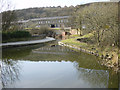

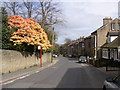

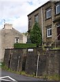
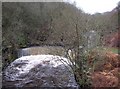
100 photos from this area
Area Information
Key information about the HD7 4DX including its size, population, and administrative classification.
- Area Type
- Postcode
- Area Size
- 8696 m²
- Population
- 1691
- Population Density
- 1817 people/km²
House Prices in HD7 4DX
20
Properties
£153,247
Average Sold Price
£48,500
Lowest Price
£318,500
Highest Price
Showing 20 properties
| Address | Type | Beds | Baths | Last Sale Price | Last Sale Date | |
|---|---|---|---|---|---|---|
| 35 Scarhouse Lane, Golcar, Huddersfield, HD7 4DX | Semi-detached | 3 | 1 | £245,000 | Jul 2023 | |
| 51 Scarhouse Lane, Golcar, Huddersfield, HD7 4DX | house | 2 | 1 | £181,000 | Mar 2023 | |
| 45 Scarhouse Lane, Golcar, Huddersfield, HD7 4DX | house | 2 | - | £195,000 | Aug 2022 | |
| 53 Scarhouse Lane, Golcar, Huddersfield, HD7 4DX | Terraced | 2 | 1 | £148,500 | Jun 2022 | |
| 26 Scarhouse Lane, Golcar, Huddersfield, HD7 4DX | Semi-detached | 4 | 2 | £318,500 | Jun 2021 | |
| 55 Scarhouse Lane, Golcar, Huddersfield, HD7 4DX | house | - | - | £175,000 | Mar 2020 | |
| 36 Scarhouse Lane, Golcar, Huddersfield, HD7 4DX | house | 3 | - | £265,000 | Jul 2016 | |
| 24 Scarhouse Lane, Golcar, Huddersfield, HD7 4DX | Semi-detached | 3 | 1 | £210,000 | Mar 2015 | |
| 61 Scarhouse Lane, Golcar, Huddersfield, HD7 4DX | house | - | - | £110,000 | Jun 2014 | |
| 39 Scarhouse Lane, Golcar, Huddersfield, HD7 4DX | house | - | - | £140,000 | Dec 2013 |
Page 1 of 2
Energy Efficiency in HD7 4DX
Amenities
Schools
| Rank | School | Type | Entry gender | Ages |
|---|
Explore more schools in this area
Go to Schools tabDemographics
Household Size
One person
most common
Accommodation Type
Houses
most common
Tenure
72
majority
Ethnic Group
White
most common
Religion
N/A
most common
Household Composition
N/A
most common
Age
47
median
Adults (30-64 years)
most common
Household Deprivation
N/A
with no deprivation
NS-SEC
41
in Lower managerial occupations
Explore more demographic insights in this area
Go to Demographics tabPlanning
Planning Constraints
- Flood RiskPremium
- Ramsar Wetland SitesPremium
- Area of Outstanding Natural BeautyPremium
- Protected Nature ReservePremium
- Protected WoodlandPremium