Area Overview for HD7 2UT
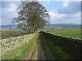
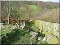
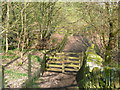
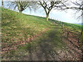
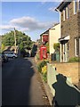
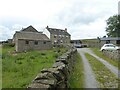
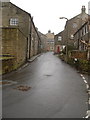
Photos of HD7 2UT

Area Information
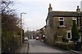
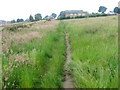
HD7 2UT is a small, tightly knit residential postcode in England, home to 1894 people spread across a compact area. With a population density of 1248 people per square kilometre, it reflects a community that is both close-knit and efficiently planned. The area is characterised by a mature demographic, with a median age of 47, suggesting a stable, established population. Most residents are adults aged 30–64, and 83% own their homes, indicating a strong sense of permanence. This is a place where families and long-term residents predominate, with housing stock focused on individual properties rather than flats. The low flood risk and minimal planning constraints make it a practical choice for those prioritising safety and ease of living. While the area is small, it is well-connected to nearby towns via rail, with stations like Brockholes and Honley within reach. For those seeking a quiet, secure neighbourhood with access to essential services, HD7 2UT offers a blend of stability and convenience.
- Area Type
- Postcode
- Area Size
- Not available
- Population
- 1894
- Population Density
- 1248 people/km²
HD7 2UT is primarily an owner-occupied area, with 83% of residents owning their homes. This high rate of home ownership suggests a community of long-term residents rather than a transient rental market. The accommodation type is predominantly houses, which is typical for small, rural postcodes where larger properties are more common. This contrasts with urban areas where flats dominate. For buyers, this means the housing stock is likely to be stable, with fewer turnover pressures. The small size of the area means the property market is limited to a few homes, but the lack of planning constraints may allow for future development. However, the focus on owner-occupation indicates that rental opportunities are scarce, making it a less attractive option for those seeking investment properties. Buyers should consider the proximity to nearby towns for additional amenities, as the immediate area is small but well-connected by rail.
House Prices in HD7 2UT
No properties found in this postcode.
Energy Efficiency in HD7 2UT
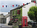
Residents of HD7 2UT have access to a range of nearby amenities, including five retail outlets such as Sainsburys Holmfirth, Co-op Holmfirth, and Lidl Holmfirth. These stores provide essential shopping options for groceries, household items, and daily needs. The rail network, with stations like Brockholes and Honley, connects the area to broader regional services, enabling easy access to larger towns for additional amenities. While the immediate area is small, the proximity to Holmfirth and surrounding towns means residents can enjoy a wider array of dining, leisure, and cultural options without long commutes. The presence of multiple retail stores and rail links enhances convenience, supporting a lifestyle that balances local convenience with regional accessibility.
Amenities
Schools
The nearest school to HD7 2UT is Upperthong Junior and Infant School, a primary school with a good Ofsted rating. This provides families with a locally available option for early education, though the absence of secondary schools means students may need to travel to nearby towns for further education. The school’s good rating suggests it meets or exceeds national standards in teaching and facilities. For families prioritising proximity to schools, this is a key advantage, but the single school type means parents must plan for secondary education elsewhere. The area’s small size means no other schools are listed, so the availability of educational options is limited to this one institution. This is important to consider for those with children requiring a range of school types or specialist provisions.
| Rank | School | Type | Entry gender | Ages |
|---|
Explore more schools in this area
Go to Schools tabDemographics
The population of HD7 2UT is predominantly adults aged 30–64, with a median age of 47. This suggests a community of middle-aged residents, many of whom may be in their prime working years or nearing retirement. Home ownership is high at 83%, reflecting a preference for long-term residency over rental properties. The area is characterised by houses rather than flats, aligning with the demographic profile of older, established households. The predominant ethnic group is White, which is common in many rural and semi-rural postcode areas. There is no data on deprivation levels, but the high home ownership and low crime risk imply a relatively stable quality of life. The absence of significant planning constraints, such as protected woodlands or Areas of Outstanding Natural Beauty, means development is not restricted, though this also suggests the area has not been designated for environmental preservation.
Household Size
Accommodation Type
Tenure
Ethnic Group
Religion
Household Composition
Age
Household Deprivation
NS-SEC
Explore more demographic insights in this area
Go to Demographics tabPlanning
Planning Constraints
- Flood RiskPremium
- Ramsar Wetland SitesPremium
- Area of Outstanding Natural BeautyPremium
- Protected Nature ReservePremium
- Protected WoodlandPremium