Area Overview for HD7 2SE
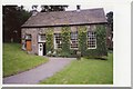
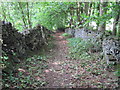
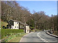
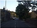
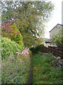
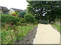
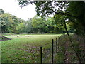
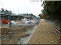
Photos of HD7 2SE
Area Information
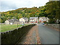
HD7 2SE is a small, tightly knit residential postcode area in England, home to 1,669 residents. Its compact size fosters a quiet, community-oriented atmosphere, typical of smaller rural clusters. The area’s population is predominantly adults aged 30–64, reflecting a mature demographic with strong ties to local amenities. Daily life here balances practicality with proximity to essential services, from nearby rail stations to well-rated schools. While the area lacks sprawling urban infrastructure, its charm lies in its simplicity and accessibility. Residents benefit from a mix of retail options and regular public transport links, making it suitable for those seeking a stable, low-maintenance lifestyle. The absence of major planning constraints or environmental restrictions means development is unlikely to disrupt the existing character. For buyers, HD7 2SE offers a snapshot of traditional English living, where home ownership is high and the pace of life remains unhurried. Its appeal lies in its straightforwardness: no excess, no complexity, just a functional, well-served community.
- Area Type
- Postcode
- Area Size
- Not available
- Population
- 1669
- Population Density
- 1785 people/km²
HD7 2SE is primarily an owner-occupied area, with 80% of properties owned by residents rather than rented out. This suggests a market driven by long-term residents rather than speculative investment. The accommodation type is predominantly houses, which is unusual for smaller postcode areas but aligns with the preference of the region’s mature demographic. The focus on single-family homes means the area lacks the high-density housing typical of urban centres, making it less suited to young professionals or large families seeking multiple properties. For buyers, this creates a niche market where properties are likely to be well-maintained and hold value over time. However, the limited availability of rental properties may restrict options for those needing short-term housing. The small size of the area also means that property values are closely tied to local amenities, such as schools and transport links, which are key factors for potential buyers.
House Prices in HD7 2SE
No properties found in this postcode.
Energy Efficiency in HD7 2SE
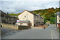
HD7 2SE offers a modest but functional array of amenities within practical reach. Five retail outlets, including Co-op Thongsbridge, Co-op Central, and Aldi 262, provide everyday shopping options for groceries and household essentials. These stores cater to the needs of a small community, reducing the necessity for long trips to larger centres. The presence of five rail stations enhances mobility, connecting residents to nearby towns for more specialised services. While the area lacks large parks or leisure facilities, its compact size means that essential services are conveniently located. The character of daily life here is defined by simplicity: a focus on local shops, reliable transport, and a low-key, community-driven rhythm. For those valuing convenience over luxury, HD7 2SE delivers a straightforward, no-frills lifestyle.
Amenities
Schools
The nearest school to HD7 2SE is Holmfirth High School, a primary institution with an outstanding Ofsted rating. This rating indicates high standards in teaching, student outcomes, and overall management, making it a strong draw for families prioritising education. The presence of a primary school within practical reach reduces the need for long commutes, a critical factor for parents balancing work and family life. While no secondary schools are listed, the proximity to Holmfirth suggests that secondary education is accessible within a short distance. The mix of school types—primarily primary—means the area caters to younger families, though those requiring secondary schooling may need to look beyond the immediate vicinity. The high rating of the primary school, combined with the area’s low population density, positions HD7 2SE as a viable option for families seeking a stable, education-focused environment.
| Rank | School | Type | Entry gender | Ages |
|---|
Explore more schools in this area
Go to Schools tabDemographics
The population of HD7 2SE is 1,669, with a median age of 47. This indicates a community skewed toward middle-aged adults, with the majority (30–64 years) forming the core demographic. Home ownership is robust at 80%, suggesting a stable, long-term resident base rather than a transient rental market. The area is dominated by houses rather than flats, aligning with the preferences of its older, family-oriented population. The predominant ethnic group is White, reflecting the broader demographic trends of rural England. While no specific deprivation data is provided, the high home ownership rate and mature age profile suggest a generally secure financial position for residents. This demographic profile implies a community focused on stability, with limited demand for short-term rental properties or student housing. The absence of significant diversity data means the area’s cultural composition remains largely homogenous.
Household Size
Accommodation Type
Tenure
Ethnic Group
Religion
Household Composition
Age
Household Deprivation
NS-SEC
Explore more demographic insights in this area
Go to Demographics tabPlanning
Planning Constraints
- Flood RiskPremium
- Ramsar Wetland SitesPremium
- Area of Outstanding Natural BeautyPremium
- Protected Nature ReservePremium
- Protected WoodlandPremium