Area Overview for HD7 2RH
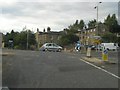
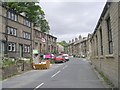
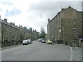
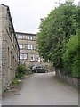
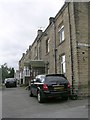
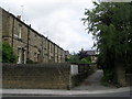
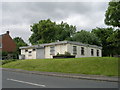
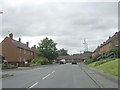
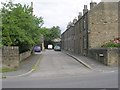
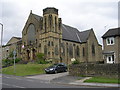
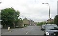
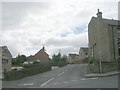
Photos of HD7 2RH
Area Information
Living in HD7 2RH offers a quiet, residential experience in a small cluster of homes that prioritise stability and convenience. With a population of 1,210, the area feels close-knit, where daily life is shaped by proximity to local amenities and reliable transport links. The community is predominantly composed of adults aged 30–64, many of whom own their homes, reflecting a settled demographic. This postcode is not defined by sprawling development but by its compact, house-dominated layout, which suits those seeking a low-maintenance lifestyle. Residents benefit from excellent broadband connectivity, ensuring seamless access to digital services, while nearby rail stations provide easy access to surrounding towns. The absence of major environmental constraints, such as protected woodlands or flood-prone areas, adds to the area’s practical appeal. For those valuing safety and simplicity, HD7 2RH offers a straightforward, predictable environment where the needs of daily living are met without unnecessary complexity.
- Area Type
- Postcode
- Area Size
- Not available
- Population
- 1210
- Population Density
- 2797 people/km²
The property market in HD7 2RH is characterised by high home ownership, with 90% of residents living in homes they own. This suggests a community of long-term residents rather than a transient rental market. The accommodation is almost exclusively houses, which is unusual for areas with higher population densities but fits HD7 2RH’s small-scale, residential nature. This focus on private ownership means the area is less likely to attract investors or short-term renters, creating a stable environment for buyers seeking a permanent home. The limited number of properties—given the small population—means the market is not oversupplied, potentially offering opportunities for those looking to purchase in a low-competition setting. However, the scarcity of data on property types or prices means buyers should consider the area’s compact size and its implications for future growth or development.
House Prices in HD7 2RH
No properties found in this postcode.
Energy Efficiency in HD7 2RH
The lifestyle in HD7 2RH is shaped by its proximity to essential retail and transport hubs. Within practical reach are five retail venues, including Budgens Honley, Co-op Honley, and Asda Honley, offering everyday shopping needs without the need to travel far. These stores provide convenience for grocery shopping, fuel, and general supplies, supporting a self-sufficient local economy. The area’s rail network, with five stations including Honley Railway Station and Berry Brow Station, connects residents to broader regional networks, enabling easy access to cultural, professional, or recreational opportunities beyond the immediate postcode. While the area lacks large-scale leisure facilities, the presence of nearby stations and shops creates a functional, low-effort lifestyle. The compact nature of HD7 2RH means amenities are not sprawling but clustered, ensuring that daily errands and travel remain straightforward.
Amenities
Schools
| Rank | School | Type | Entry gender | Ages |
|---|
Explore more schools in this area
Go to Schools tabDemographics
The community in HD7 2RH is predominantly composed of adults aged 30–64, with a median age of 47, indicating a mature, established population. Over 90% of residents own their homes, a figure that underscores the area’s stability and long-term residency. The accommodation is almost entirely houses, reflecting a preference for single-family living rather than flats or shared housing. The predominant ethnic group is White, with no specific data provided on other demographics. This homogeneity, while not explicitly stated as a challenge or advantage, aligns with the area’s low population density and focus on private ownership. The relatively small population of 1,210 means the community is tightly knit, with limited social diversity but strong local ties. For those prioritising a settled, low-turnover environment, HD7 2RH’s demographic profile offers consistency and familiarity.
Household Size
Accommodation Type
Tenure
Ethnic Group
Religion
Household Composition
Age
Household Deprivation
NS-SEC
Explore more demographic insights in this area
Go to Demographics tabPlanning
Planning Constraints
- Flood RiskPremium
- Ramsar Wetland SitesPremium
- Area of Outstanding Natural BeautyPremium
- Protected Nature ReservePremium
- Protected WoodlandPremium