Area Overview for HD7 2LR
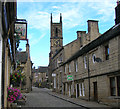
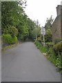
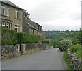
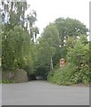
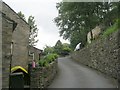
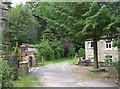
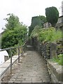
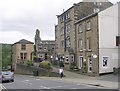
Photos of HD7 2LR


Area Information
HD7 2LR is a small, tightly knit residential area in England, home to around 2,341 people. Its compact size fosters a quiet, community-focused atmosphere, typical of smaller postcode clusters. The area is characterised by a predominance of houses, reflecting a stable, owner-occupied demographic. With a median age of 47, the population skews toward adults aged 30–64, suggesting a mix of established families and professionals. This age group likely contributes to the area’s steady pace of life, with fewer young families or retirees compared to larger urban centres. The proximity to Honley Railway Station and Berry Brow Station offers easy access to regional transport networks, while nearby retail outlets like Asda Honley and Co-op Honley provide essential services. For those seeking a balance between convenience and tranquillity, HD7 2LR offers a snapshot of suburban living, with minimal environmental constraints and low crime risk. Its small footprint means amenities are within practical reach, making it appealing to those prioritising walkability and a sense of place.
- Area Type
- Postcode
- Area Size
- Not available
- Population
- 2341
- Population Density
- 2496 people/km²
The property market in HD7 2LR is defined by a 61% home ownership rate, indicating that most residents live in their own homes rather than renting. This suggests a stable, owner-occupied market, which can be attractive to buyers seeking long-term investment or a place to settle. The area’s housing stock is predominantly houses, which may appeal to those prioritising space and privacy over high-density living. As a small postcode cluster, the market is likely limited in scale, with properties concentrated in the immediate vicinity. Buyers should consider the area’s compact nature, as housing options may be fewer compared to larger towns. The lack of rental-heavy demographics also implies that properties are less likely to be available for short-term tenancy, which could be a consideration for those seeking flexibility. For those valuing a quiet, established neighbourhood, HD7 2LR offers a straightforward, low-maintenance property market.
House Prices in HD7 2LR
No properties found in this postcode.
Energy Efficiency in HD7 2LR
Daily life in HD7 2LR is shaped by its accessible amenities and suburban character. The nearby retail outlets—Asda Honley, Co-op Honley, and Budgens Honley—offer a range of grocery and convenience services, reducing the need for long trips to larger centres. The presence of multiple railway stations, including Honley and Berry Brow, provides straightforward access to regional transport networks, connecting residents to nearby towns and cities. While the area lacks large parks or leisure facilities, its small size ensures that essential services are within practical reach. The combination of retail convenience and transport options supports a lifestyle that balances self-sufficiency with connectivity. For those who enjoy a slower pace, the absence of major urban hubs means a focus on local amenities and community-centric living.
Amenities
Schools
Residents of HD7 2LR have access to two notable schools: Honley Church of England Voluntary Controlled Infant and Nursery School, a primary school, and Honley Preparatory School, an independent institution. The presence of both state and independent options provides families with choices tailored to their preferences. The primary school offers a foundation for early education, while the preparatory school caters to older children, potentially attracting families seeking structured, fee-paying education. The mix of school types reflects the area’s diversity in educational provision, though specific Ofsted ratings are not included in the data. For families prioritising state education, the primary school’s proximity ensures ease of access, while those seeking independent schooling may find the preparatory school a viable option. The availability of these institutions supports the area’s appeal to households with children.
| Rank | School | Type | Entry gender | Ages |
|---|
Explore more schools in this area
Go to Schools tabDemographics
The community in HD7 2LR is predominantly composed of adults aged 30–64, with a median age of 47. This suggests a mature population, likely with established careers and long-term ties to the area. Home ownership stands at 61%, indicating a stable housing market with a significant proportion of residents living in their own homes. The accommodation type is primarily houses, which aligns with the area’s suburban character and may appeal to those seeking more space than a flat. The predominant ethnic group is White, reflecting the broader demographic trends in the region. While specific data on deprivation is not provided, the combination of low crime risk (73/100) and accessible amenities suggests a quality of life that balances practicality with safety. The absence of protected natural sites or planning constraints further supports a lifestyle free from regulatory complications.
Household Size
Accommodation Type
Tenure
Ethnic Group
Religion
Household Composition
Age
Household Deprivation
NS-SEC
Explore more demographic insights in this area
Go to Demographics tabPlanning
Planning Constraints
- Flood RiskPremium
- Ramsar Wetland SitesPremium
- Area of Outstanding Natural BeautyPremium
- Protected Nature ReservePremium
- Protected WoodlandPremium