Area Overview for HD7 2FW
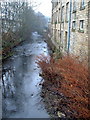
Photos of HD7 2FW
Area Information
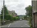
HD7 2FW is a small, tightly knit residential area in England, home to 1813 people spread across a compact postcode cluster. With a population density of 943 people per square kilometre, it reflects a mix of established housing and community cohesion. Daily life here is characterised by proximity to local amenities and a relatively low population, offering a quieter alternative to larger towns. The area’s appeal lies in its balance of practicality and accessibility, with nearby rail links and a range of retail options within walking distance. While it lacks the vibrancy of urban centres, its small-scale nature fosters a sense of familiarity among residents. For those seeking a place with manageable size and straightforward living, HD7 2FW provides a foundation of stability. Its position near key infrastructure and services makes it a viable choice for buyers prioritising convenience over sprawling landscapes. The absence of major environmental constraints, such as protected woodlands or AONB designations, ensures development and housing options remain unencumbered.
- Area Type
- Postcode
- Area Size
- Not available
- Population
- 1813
- Population Density
- 943 people/km²
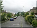
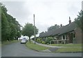
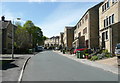
HD7 2FW is predominantly an owner-occupied area, with 83% of homes owned by residents rather than rented. The accommodation type is largely houses, which is typical for smaller postcode clusters where larger plots are available. This suggests a housing stock that prioritises private ownership over flats or shared living arrangements. The small size of the area means the market is limited in scale, but the focus on houses indicates a potential for family homes or properties with garden space. Buyers should consider the area’s compact nature, which may restrict the availability of new developments. For those seeking a stable, low-risk investment, the high home ownership rate and absence of planning constraints make HD7 2FW a practical choice. However, the lack of rental properties implies a market more suited to long-term residency than short-term lettings.
House Prices in HD7 2FW
No properties found in this postcode.
Energy Efficiency in HD7 2FW
The lifestyle in HD7 2FW is shaped by its proximity to retail and transport hubs. Local shops include Aldi 262, Co-op Thongsbridge, and Co-op Central, offering everyday essentials within walking distance. These stores cater to practical needs, though the area lacks larger supermarkets or specialist retailers. The rail stations provide access to broader leisure and employment opportunities, while the absence of parks or recreational facilities means outdoor activities may require travel. The small scale of the area fosters a straightforward, utilitarian lifestyle, with amenities focused on convenience rather than diversity. For residents prioritising ease of access over extensive leisure options, HD7 2FW offers a functional, no-frills environment.
Amenities
Schools
The nearest school to HD7 2FW is Netherthong Primary School, which serves the local community with a good Ofsted rating. This primary school is the only educational institution explicitly listed in the data, meaning families with children may need to look beyond the immediate area for secondary education. The presence of a rated primary school is a positive factor for parents prioritising local schooling, though the absence of secondary options could influence decisions for larger families. The school’s quality rating suggests a focus on foundational education, but buyers should verify the availability of secondary schools in nearby towns. For those valuing accessible education, HD7 2FW’s proximity to Netherthong Primary is a key consideration.
| Rank | School | Type | Entry gender | Ages |
|---|
Explore more schools in this area
Go to Schools tabDemographics
The population of HD7 2FW skews towards adults aged 30–64, with a median age of 47. This suggests a community rooted in established households rather than young families or retirees. Home ownership is high, with 83% of residents living in owner-occupied properties, indicating a preference for long-term investment over rental living. The predominant accommodation type is houses, which aligns with the area’s lower density and more spread-out layout. The ethnic composition is largely White, reflecting broader regional patterns. While no specific data on deprivation is provided, the high home ownership rate and absence of environmental constraints suggest a relatively stable quality of life. The demographic profile implies a mature, settled population with fewer transient residents, contributing to a consistent local character.
Household Size
Accommodation Type
Tenure
Ethnic Group
Religion
Household Composition
Age
Household Deprivation
NS-SEC
Explore more demographic insights in this area
Go to Demographics tabPlanning
Planning Constraints
- Flood RiskPremium
- Ramsar Wetland SitesPremium
- Area of Outstanding Natural BeautyPremium
- Protected Nature ReservePremium
- Protected WoodlandPremium