Area Overview for HD7 1WE
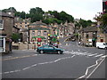
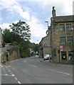
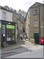
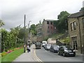
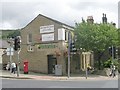
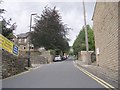
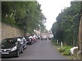
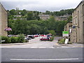
Photos of HD7 1WE
Area Information
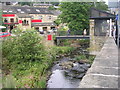
Living in HD7 1WE offers a compact, residential experience shaped by its small cluster of homes and proximity to essential services. With a population of 1,669, this area is characterised by a quiet, established community where most residents are adults aged 30–64. The postcode’s layout suggests a low-density housing stock, likely with gardens and private spaces, catering to families and individuals seeking stability. Nearby, residents have access to retail options like Co-op Holmfirth and Lidl Holmfirth, as well as rail links to Brockholes, Honley, and Stocksmoor stations, which connect to broader networks. The presence of Holmfirth High School, rated outstanding by Ofsted, underscores the area’s appeal for families prioritising education. While the population size means a close-knit feel, the area’s practical amenities and transport links make it suitable for those balancing local convenience with regional connectivity. HD7 1WE is not a sprawling suburb but a focused community where daily life revolves around familiar faces, local shops, and the rhythm of train schedules.
- Area Type
- Postcode
- Area Size
- Not available
- Population
- 1669
- Population Density
- 1785 people/km²
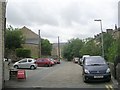
HD7 1WE is a predominantly owner-occupied area, with 80% of homes owned by residents. The accommodation type is exclusively houses, which is unusual for a small postcode but suggests a focus on single-family dwellings with private gardens. This housing stock likely appeals to buyers seeking stability, space, and a quieter lifestyle. The high home ownership rate indicates a community of long-term residents rather than a rental-heavy market, which can affect property values and demand. Given the area’s size and the prevalence of houses, the property market is likely niche, with limited options for buyers. Those considering HD7 1WE should note that the housing stock is not diverse in terms of property types, which may limit choices for those seeking flats or apartments. The small cluster of homes also means that the immediate surroundings are critical for buyers, as the area’s character is defined by its proximity to nearby amenities and transport links.
House Prices in HD7 1WE
No properties found in this postcode.
Energy Efficiency in HD7 1WE
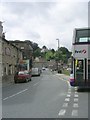
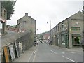
The lifestyle in HD7 1WE is shaped by its proximity to retail and transport hubs. Within practical reach are five retail outlets, including Co-op Holmfirth, Lidl Holmfirth, and Co-op Central, offering everyday shopping needs. These stores cater to a range of preferences, from budget-friendly options to more established chains. The rail network, with stations at Brockholes, Honley, and Stocksmoor, provides easy access to nearby towns and cities, enhancing the area’s connectivity. While the data does not mention parks or leisure facilities, the presence of multiple rail stations and shops suggests a balance between local convenience and regional opportunities. The area’s character is defined by its small-scale amenities, making it ideal for those who value a self-contained lifestyle without sacrificing access to broader services.
Amenities
Schools
The nearest school to HD7 1WE is Holmfirth High School, a primary school with an outstanding Ofsted rating. This rating indicates high standards in teaching, pupil outcomes, and overall management, making it a strong draw for families. The presence of a single primary school in the area suggests that secondary education options may be located further afield, requiring consideration of commuting distances. For families prioritising education, the outstanding rating at Holmfirth High School is a significant advantage, though the lack of additional schools in the immediate vicinity could be a limitation. The school’s performance also implies that the area may attract households with children, contributing to its community profile. Parents should verify whether the school’s capacity meets local demand, though the rating itself is a clear indicator of quality.
| Rank | School | Type | Entry gender | Ages |
|---|
Explore more schools in this area
Go to Schools tabDemographics
The community in HD7 1WE is predominantly composed of adults aged 30–64, with a median age of 47. This suggests a mature population, likely with established careers and families. Home ownership is high, at 80%, indicating a stable, long-term resident base. The accommodation type is primarily houses, which aligns with the area’s residential cluster description and may reflect a preference for private, spacious living. The predominant ethnic group is White, though no specific data on diversity or deprivation is provided. The absence of detailed diversity metrics means the area’s social composition remains largely unexplored in this context. The age profile suggests a community with a mix of middle-aged professionals and retirees, potentially influencing local services and amenities. With 80% of homes owned rather than rented, the area is less likely to experience the transient nature of rental markets, contributing to a sense of continuity.
Household Size
Accommodation Type
Tenure
Ethnic Group
Religion
Household Composition
Age
Household Deprivation
NS-SEC
Explore more demographic insights in this area
Go to Demographics tabPlanning
Planning Constraints
- Flood RiskPremium
- Ramsar Wetland SitesPremium
- Area of Outstanding Natural BeautyPremium
- Protected Nature ReservePremium
- Protected WoodlandPremium