Area Overview for HD6 3RD
Photos of HD6 3RD
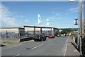
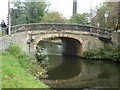
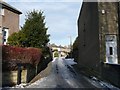
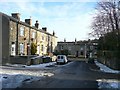
100 photos from this area
Area Information
Key information about the HD6 3RD including its size, population, and administrative classification.
- Area Type
- Postcode
- Area Size
- 1.3 hectares
- Population
- 1569
- Population Density
- 2434 people/km²
House Prices in HD6 3RD
25
Properties
£143,238
Average Sold Price
£3,500
Lowest Price
£390,000
Highest Price
Showing 25 properties
| Address | Type | Beds | Baths | Last Sale Price | Last Sale Date | |
|---|---|---|---|---|---|---|
| 60 Huddersfield Road, Brighouse, HD6 3RD | Terraced | 1 | 1 | £70,000 | Oct 2025 | |
| 58 Huddersfield Road, Brighouse, HD6 3RD | Semi-detached | 3 | 1 | £167,000 | May 2023 | |
| 86 Huddersfield Road, Brighouse, HD6 3RD | house | - | - | £390,000 | Sep 2021 | |
| 78 Huddersfield Road, Brighouse, HD6 3RD | house | - | - | £260,000 | May 2020 | |
| 88 Huddersfield Road, Brighouse, HD6 3RD | house | - | - | £95,000 | Jan 2018 | |
| 70 Huddersfield Road, Brighouse, HD6 3RD | Detached | 5 | - | £3,500 | Aug 2017 | |
| 94 Huddersfield Road, Brighouse, HD6 3RD | Cottage | 1 | 1 | £73,650 | Aug 2015 | |
| 54 Huddersfield Road, Brighouse, HD6 3RD | Terraced | 2 | 1 | £90,000 | Jun 2015 | |
| 92 Huddersfield Road, Brighouse, HD6 3RD | house | - | - | £90,000 | May 2015 | |
| 84 Huddersfield Road, Brighouse, HD6 3RD | Detached | 5 | 1 | £286,150 | Jul 2014 |
Page 1 of 3
Energy Efficiency in HD6 3RD
Amenities
Schools
| Rank | School | Type | Entry gender | Ages |
|---|
Explore more schools in this area
Go to Schools tabDemographics
Household Size
One person
most common
Accommodation Type
Houses
most common
Tenure
63
majority
Ethnic Group
White
most common
Religion
N/A
most common
Household Composition
N/A
most common
Age
47
median
Adults (30-64 years)
most common
Household Deprivation
N/A
with no deprivation
NS-SEC
31
in Lower managerial occupations
Explore more demographic insights in this area
Go to Demographics tabPlanning
Planning Constraints
- Flood RiskPremium
- Ramsar Wetland SitesPremium
- Area of Outstanding Natural BeautyPremium
- Protected Nature ReservePremium
- Protected WoodlandPremium