Area Overview for HD6 3LP
Photos of HD6 3LP
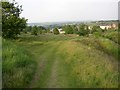
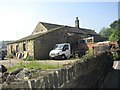
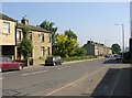
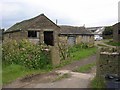
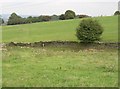
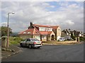
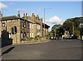
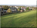
100 photos from this area
Area Information
Key information about the HD6 3LP including its size, population, and administrative classification.
- Area Type
- Postcode
- Area Size
- 5845 m²
- Population
- 1722
- Population Density
- 2153 people/km²
House Prices in HD6 3LP
26
Properties
£102,494
Average Sold Price
£31,000
Lowest Price
£187,500
Highest Price
Showing 26 properties
| Address | Type | Beds | Baths | Last Sale Price | Last Sale Date | |
|---|---|---|---|---|---|---|
| 12 New Hey Road, Rastrick, Brighouse, HD6 3LP | house | - | - | £120,000 | Jul 2025 | |
| 9 New Hey Road, Rastrick, Brighouse, HD6 3LP | house | - | - | £140,000 | May 2023 | |
| 4 New Hey Road, Rastrick, Brighouse, HD6 3LP | Cottage | 2 | 1 | £35,000 | Apr 2022 | |
| 20 New Hey Road, Rastrick, Brighouse, HD6 3LP | Cottage | 3 | 1 | £161,000 | Sep 2021 | |
| 15 New Hey Road, Rastrick, Brighouse, HD6 3LP | house | 2 | - | £130,000 | Feb 2021 | |
| 27-29 New Hey Road, Rastrick, Brighouse, HD6 3LP | Detached | 3 | 1 | £187,500 | Jul 2020 | |
| 10 New Hey Road, Rastrick, Brighouse, HD6 3LP | Terraced | 3 | 1 | £132,000 | Jul 2017 | |
| 14 New Hey Road, Rastrick, Brighouse, HD6 3LP | house | - | - | £122,500 | Sep 2016 | |
| 17 New Hey Road, Rastrick, Brighouse, HD6 3LP | house | - | - | £114,950 | Nov 2014 | |
| 8 New Hey Road, Rastrick, Brighouse, HD6 3LP | house | 3 | - | £115,000 | Apr 2014 |
Page 1 of 3
Energy Efficiency in HD6 3LP
Amenities
Schools
| Rank | School | Type | Entry gender | Ages |
|---|
Explore more schools in this area
Go to Schools tabDemographics
Household Size
One person
most common
Accommodation Type
Houses
most common
Tenure
51
majority
Ethnic Group
White
most common
Religion
N/A
most common
Household Composition
N/A
most common
Age
47
median
Adults (30-64 years)
most common
Household Deprivation
N/A
with no deprivation
NS-SEC
26
in Lower managerial occupations
Explore more demographic insights in this area
Go to Demographics tabPlanning
Planning Constraints
- Flood RiskPremium
- Ramsar Wetland SitesPremium
- Area of Outstanding Natural BeautyPremium
- Protected Nature ReservePremium
- Protected WoodlandPremium