Area Overview for HD6 3JH
Photos of HD6 3JH
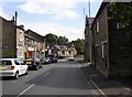
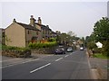
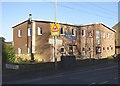
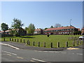
100 photos from this area
Area Information
Key information about the HD6 3JH including its size, population, and administrative classification.
- Area Type
- Postcode
- Area Size
- 3.7 hectares
- Population
- 1382
- Population Density
- 1901 people/km²
House Prices in HD6 3JH
69
Properties
£104,107
Average Sold Price
£34,250
Lowest Price
£175,000
Highest Price
Showing 69 properties
| Address | Type | Beds | Baths | Last Sale Price | Last Sale Date | |
|---|---|---|---|---|---|---|
| 26 Sherburn Road, Brighouse, HD6 3JH | Terraced | 3 | 2 | £173,000 | Jul 2024 | |
| 20 Sherburn Road, Brighouse, HD6 3JH | house | - | - | £175,000 | Jul 2022 | |
| 44 Sherburn Road, Brighouse, HD6 3JH | house | - | - | £138,000 | Mar 2022 | |
| 40 Sherburn Road, Brighouse, HD6 3JH | house | - | - | £128,500 | Nov 2021 | |
| 6 Sherburn Road, Brighouse, HD6 3JH | Semi-detached | 3 | 1 | £170,000 | May 2019 | |
| 10 Sherburn Road, Brighouse, HD6 3JH | Semi-detached | - | - | £124,950 | Jul 2008 | |
| 12 Sherburn Road, Brighouse, HD6 3JH | house | - | - | £98,000 | Feb 2007 | |
| 8 Sherburn Road, Brighouse, HD6 3JH | Semi-detached | - | - | £115,000 | May 2005 | |
| 42 Sherburn Road, Brighouse, HD6 3JH | Terraced | 3 | 2 | £84,000 | Dec 2004 | |
| 1 Sherburn Road, Brighouse, HD6 3JH | house | - | - | £119,950 | May 2004 |
Page 1 of 7
Energy Efficiency in HD6 3JH
Amenities
Schools
| Rank | School | Type | Entry gender | Ages |
|---|
Explore more schools in this area
Go to Schools tabDemographics
Household Size
One person
most common
Accommodation Type
Houses
most common
Tenure
61
majority
Ethnic Group
White
most common
Religion
N/A
most common
Household Composition
N/A
most common
Age
47
median
Adults (30-64 years)
most common
Household Deprivation
N/A
with no deprivation
NS-SEC
27
in Lower managerial occupations
Explore more demographic insights in this area
Go to Demographics tabPlanning
Planning Constraints
- Flood RiskPremium
- Ramsar Wetland SitesPremium
- Area of Outstanding Natural BeautyPremium
- Protected Nature ReservePremium
- Protected WoodlandPremium