Area Overview for HD6 2PA
Photos of HD6 2PA
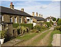
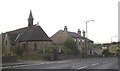
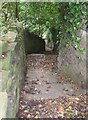
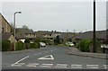
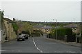
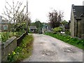
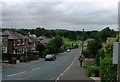
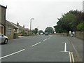
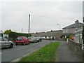
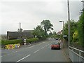
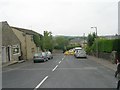
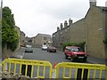
100 photos from this area
Area Information
Key information about the HD6 2PA including its size, population, and administrative classification.
- Area Type
- Postcode
- Area Size
- 1.9 hectares
- Population
- 1589
- Population Density
- 3000 people/km²
House Prices in HD6 2PA
14
Properties
£227,889
Average Sold Price
£87,000
Lowest Price
£480,000
Highest Price
Showing 14 properties
| Address | Type | Beds | Baths | Last Sale Price | Last Sale Date | |
|---|---|---|---|---|---|---|
| Belvedere, 51 Upper Green Lane, Hove Edge, Brighouse, HD6 2PA | Semi-detached | 2 | 1 | £120,000 | Jun 2024 | |
| 39 Upper Green Lane, Hove Edge, Brighouse, HD6 2PA | Detached | 4 | 3 | £480,000 | Aug 2023 | |
| 33 Upper Green Lane, Hove Edge, Brighouse, HD6 2PA | Semi-detached | 3 | 1 | £295,000 | Jan 2022 | |
| 47 Upper Green Lane, Hove Edge, Brighouse, HD6 2PA | house | - | - | £160,000 | Feb 2021 | |
| 37 Upper Green Lane, Hove Edge, Brighouse, HD6 2PA | house | - | - | £290,000 | Aug 2019 | |
| 45 Upper Green Lane, Hove Edge, Brighouse, HD6 2PA | Terraced | 3 | - | £188,000 | Nov 2014 | |
| 27 Upper Green Lane, Hove Edge, Brighouse, HD6 2PA | Terraced | 3 | - | £240,000 | Apr 2010 | |
| 29 Upper Green Lane, Hove Edge, Brighouse, HD6 2PA | Semi-detached | 3 | 1 | £191,000 | Aug 2007 | |
| 41 Upper Green Lane, Hove Edge, Brighouse, HD6 2PA | Terraced | - | - | £87,000 | Nov 2001 | |
| Halva, Upper Green Lane, Hove Edge, Brighouse, HD6 2PA | Detached | - | - | - | - |
Page 1 of 2
Energy Efficiency in HD6 2PA
Amenities
Schools
| Rank | School | Type | Entry gender | Ages |
|---|
Explore more schools in this area
Go to Schools tabDemographics
Household Size
Two person
most common
Accommodation Type
Houses
most common
Tenure
88
majority
Ethnic Group
White
most common
Religion
N/A
most common
Household Composition
N/A
most common
Age
47
median
Adults (30-64 years)
most common
Household Deprivation
N/A
with no deprivation
NS-SEC
43
in Lower managerial occupations
Explore more demographic insights in this area
Go to Demographics tabPlanning
Planning Constraints
- Flood RiskPremium
- Ramsar Wetland SitesPremium
- Area of Outstanding Natural BeautyPremium
- Protected Nature ReservePremium
- Protected WoodlandPremium