Area Overview for HD5 9PJ
Photos of HD5 9PJ
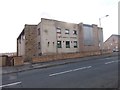
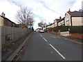
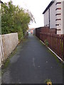
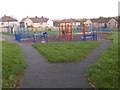
93 photos from this area
Area Information
Key information about the HD5 9PJ including its size, population, and administrative classification.
- Area Type
- Postcode
- Area Size
- 6443 m²
- Population
- 1459
- Population Density
- 1594 people/km²
House Prices in HD5 9PJ
13
Properties
£68,750
Average Sold Price
£40,000
Lowest Price
£97,500
Highest Price
Showing 13 properties
| Address | Type | Beds | Baths | Last Sale Price | Last Sale Date | |
|---|---|---|---|---|---|---|
| 154 Bradley Mills Road, Rawthorpe, Huddersfield, HD5 9PJ | Semi-detached | - | - | £97,500 | Dec 2006 | |
| 156 Bradley Mills Road, Rawthorpe, Huddersfield, HD5 9PJ | Semi-detached | - | - | £40,000 | May 2000 | |
| 138 Bradley Mills Road, Rawthorpe, Huddersfield, HD5 9PJ | house | - | - | - | - | |
| 136 Bradley Mills Road, Rawthorpe, Huddersfield, HD5 9PJ | house | - | - | - | - | |
| 150 Bradley Mills Road, Rawthorpe, Huddersfield, HD5 9PJ | Semi-detached | - | - | - | - | |
| 152 Bradley Mills Road, Rawthorpe, Huddersfield, HD5 9PJ | house | - | - | - | - | |
| 134 Bradley Mills Road, Rawthorpe, Huddersfield, HD5 9PJ | house | - | - | - | - | |
| 144 Bradley Mills Road, Rawthorpe, Huddersfield, HD5 9PJ | Terraced | - | - | - | - | |
| 146 Bradley Mills Road, Rawthorpe, Huddersfield, HD5 9PJ | Terraced | - | - | - | - | |
| 132 Bradley Mills Road, Rawthorpe, Huddersfield, HD5 9PJ | Semi-detached | - | - | - | - |
Page 1 of 2
Energy Efficiency in HD5 9PJ
Amenities
Schools
| Rank | School | Type | Entry gender | Ages |
|---|
Explore more schools in this area
Go to Schools tabDemographics
Household Size
One person
most common
Accommodation Type
Houses
most common
Tenure
35
majority
Ethnic Group
White
most common
Religion
N/A
most common
Household Composition
N/A
most common
Age
47
median
Adults (30-64 years)
most common
Household Deprivation
N/A
with no deprivation
NS-SEC
14
in Lower managerial occupations
Explore more demographic insights in this area
Go to Demographics tabPlanning
Planning Constraints
- Flood RiskPremium
- Ramsar Wetland SitesPremium
- Area of Outstanding Natural BeautyPremium
- Protected Nature ReservePremium
- Protected WoodlandPremium