Area Overview for HD5 9BA
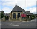
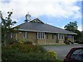
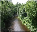
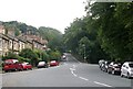
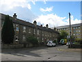
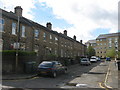
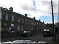
Photos of HD5 9BA

Area Information
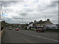
HD5 9BA is a small, tightly packed residential cluster in England, covering just 2.8 hectares. With a population of 2,236 people, it is densely populated at 1,157 residents per square kilometre. This area is defined by its youthful demographic, with a median age of 22 and most residents aged between 15 and 29. Daily life here is shaped by proximity to key services, including five retail outlets such as Asda Aspley and Sainsburys Shorehead, and five rail stations, including Huddersfield Railway Station. The area’s compact size means most amenities are within walking or cycling distance. While the community is small, it is served by essential infrastructure, including independent schools and digital connectivity rated 83 for both broadband and mobile networks. However, the area’s character is influenced by its high crime risk, which is above average. For those seeking a compact, accessible location with a young population, HD5 9BA offers a mix of convenience and challenges.
- Area Type
- Postcode
- Area Size
- 2.8 hectares
- Population
- 2236
- Population Density
- 1157 people/km²
HD5 9BA is not a high home ownership area, with only 17% of residents owning their homes. This suggests the market is primarily rental-based, catering to tenants rather than long-term buyers. The accommodation type is predominantly houses, which is unusual for a small, densely populated area. This may indicate a mix of older, single-family homes and smaller properties, but the lack of data on property sizes or types limits further analysis. For buyers, the small area size and limited housing stock mean competition is likely high, particularly for owner-occupied properties. The proximity to rail stations and retail hubs may make it appealing for those prioritising accessibility over space, though the high crime risk could deter some buyers.
House Prices in HD5 9BA
No properties found in this postcode.
Energy Efficiency in HD5 9BA
Residents of HD5 9BA have access to five retail outlets, including Asda Aspley and Iceland Huddersfield, ensuring basic shopping needs are met locally. The area’s rail stations, such as Deighton Railway Station, provide links to nearby towns and cities, enhancing mobility. While the data does not mention parks or leisure facilities, the proximity to rail and retail suggests a focus on convenience over expansive recreational spaces. The small size of the area means daily life is centred around these core amenities, with limited scope for large-scale leisure or cultural offerings.
Amenities
Schools
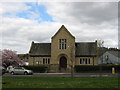
The nearest school to HD5 9BA is New Directions College, an independent institution. No other schools are listed in the data, so families seeking state education may need to look beyond the immediate area. The presence of an independent school suggests the area may attract households prioritising private education, though it does not indicate the quality of local state schools. Parents should consider the limited school options and potential need for commuting to other parts of the region for state-run institutions.
| Rank | School | Type | Entry gender | Ages |
|---|
Explore more schools in this area
Go to Schools tabDemographics
The population of HD5 9BA is overwhelmingly young, with a median age of 22 and 83% of residents falling within the 15–29 age range. Only 17% of households are owner-occupied, suggesting a rental-dominated market. The accommodation type is predominantly houses, reflecting a lack of high-density housing. The predominant ethnic group is White, though no specific data on diversity beyond this is provided. With a population density of 1,157 people per square kilometre, the area is among the most densely populated in England. This density, combined with the young age profile, indicates a community likely centred around students, young professionals, or those in transitional life stages. The low home ownership rate may reflect temporary housing needs or economic factors affecting long-term investment in property.
Household Size
Accommodation Type
Tenure
Ethnic Group
Religion
Household Composition
Age
Household Deprivation
NS-SEC
Explore more demographic insights in this area
Go to Demographics tabPlanning
Planning Constraints
- Flood RiskPremium
- Ramsar Wetland SitesPremium
- Area of Outstanding Natural BeautyPremium
- Protected Nature ReservePremium
- Protected WoodlandPremium