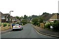
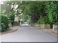
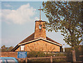
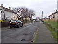
Area Overview for HD5 8YR
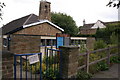
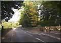
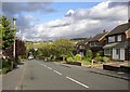
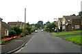
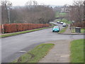
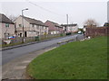
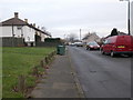
Photos of HD5 8YR

Area Information
HD5 8YR is a small residential postcode area in England, home to 1,583 residents. It is a compact cluster of properties, predominantly houses, serving a community of adults aged 30–64, with a median age of 47. This area is characterised by its quiet, suburban feel, with no major urban infrastructure or industrial presence. Daily life here is shaped by proximity to local amenities such as Co-op Almondbury and nearby railway stations, which provide access to regional hubs like Huddersfield. The area’s small size means it is not densely populated, offering a sense of space without the congestion of larger towns. While it lacks the cultural or commercial vibrancy of bigger cities, its simplicity and accessibility make it appealing to those prioritising stability and practicality. The absence of environmental constraints like protected woodlands or AONB designations means development is not restricted, though the high crime risk score of 11/100 warrants caution. For buyers seeking a low-maintenance, family-oriented environment with basic services within reach, HD5 8YR presents a straightforward, if unexciting, proposition.
- Area Type
- Postcode
- Area Size
- Not available
- Population
- 1583
- Population Density
- 4638 people/km²
The property market in HD5 8YR is dominated by owner-occupied homes, with 51% of residents living in properties they own. This suggests a mix of long-term residents and those seeking stable, low-maintenance housing. The area’s housing stock is primarily composed of houses, which are typically larger and more suited to families than flats. Given the small size of the postcode and its focus on single-family homes, the market is unlikely to cater to short-term renters or young professionals seeking apartments. Buyers should consider that the limited number of properties may mean competition is low, but the immediate surroundings may offer more options. The absence of planning constraints like AONB or protected woodlands means development is not restricted, though the high crime risk score may affect desirability. For those prioritising space and a quiet lifestyle, this area offers a straightforward, if modest, housing proposition.
House Prices in HD5 8YR
No properties found in this postcode.
Energy Efficiency in HD5 8YR
The lifestyle in HD5 8YR is shaped by its proximity to essential amenities. Within practical reach are five retail outlets, including Co-op Almondbury, Aldi Dalton, and Morrisons Dalton, offering a range of shopping and grocery options. These stores cater to daily needs, reducing the necessity for long trips to larger towns. The area’s rail connections provide access to Huddersfield and surrounding stations, enabling residents to explore broader leisure opportunities or commute to work. While there is no mention of parks or recreational spaces in the data, the absence of environmental constraints like protected woodlands or AONB designations suggests open spaces may be available. The combination of retail convenience and rail access creates a functional, if unremarkable, lifestyle. Residents can expect a straightforward, low-stimulus environment focused on practicality rather than cultural or social amenities.
Amenities
Schools
The nearest school to HD5 8YR is Almondbury Community School, a primary institution serving the local area. No secondary schools are listed in the data, meaning families may need to look beyond the immediate postcode for comprehensive education. The presence of a primary school is a practical advantage for young children, though parents seeking secondary education will need to consider commuting to nearby towns. The single school listed suggests a limited range of educational options, which may be a concern for families with older children. Without additional data on Ofsted ratings or curriculum quality, it is unclear whether the school meets high standards. However, its existence indicates that basic educational needs are met within the area, making it a consideration for buyers prioritising proximity to schools.
| Rank | School | Type | Entry gender | Ages |
|---|
Explore more schools in this area
Go to Schools tabDemographics
The population of HD5 8YR is 1,583, with a median age of 47, indicating a mature demographic. The most common age range is adults aged 30–64, suggesting a community of established professionals and families. Home ownership here is at 51%, meaning nearly half of residents live in properties they own, while the remainder are likely renters. The area is predominantly composed of houses, reflecting a focus on single-family dwellings rather than flats or apartments. The predominant ethnic group is White, though no specific data on diversity or deprivation levels is provided. This age profile and housing stock suggest a stable, long-term resident base, though the lack of younger families or students may limit the local economy’s dynamism. The high proportion of adult residents also implies a low demand for childcare facilities or schools catering to younger children, which aligns with the presence of only one primary school nearby.
Household Size
Accommodation Type
Tenure
Ethnic Group
Religion
Household Composition
Age
Household Deprivation
NS-SEC
Explore more demographic insights in this area
Go to Demographics tabPlanning
Planning Constraints
- Flood RiskPremium
- Ramsar Wetland SitesPremium
- Area of Outstanding Natural BeautyPremium
- Protected Nature ReservePremium
- Protected WoodlandPremium