Area Overview for HD5 8QD
Photos of HD5 8QD

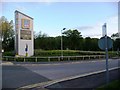
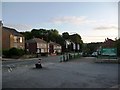

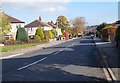
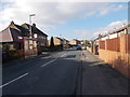
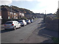
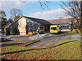

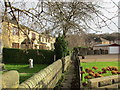
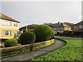
87 photos from this area
Area Information
Key information about the HD5 8QD including its size, population, and administrative classification.
- Area Type
- Postcode
- Area Size
- 1.0 hectares
- Population
- 1526
- Population Density
- 6615 people/km²
House Prices in HD5 8QD
36
Properties
£95,425
Average Sold Price
£32,500
Lowest Price
£165,000
Highest Price
Showing 36 properties
| Address | Type | Beds | Baths | Last Sale Price | Last Sale Date | |
|---|---|---|---|---|---|---|
| 36 Waterloo Rise, Waterloo, Huddersfield, HD5 8QD | house | 3 | 1 | £160,000 | Jun 2024 | |
| 44 Waterloo Rise, Waterloo, Huddersfield, HD5 8QD | Terraced | 3 | 1 | £150,000 | Jun 2022 | |
| 10 Waterloo Rise, Waterloo, Huddersfield, HD5 8QD | house | - | - | £165,000 | Oct 2021 | |
| 14 Waterloo Rise, Waterloo, Huddersfield, HD5 8QD | Terraced | 3 | - | £110,000 | Dec 2018 | |
| 28 Waterloo Rise, Waterloo, Huddersfield, HD5 8QD | Terraced | 3 | - | £77,000 | Aug 2015 | |
| 20 Waterloo Rise, Waterloo, Huddersfield, HD5 8QD | Terraced | 3 | - | £109,950 | Nov 2014 | |
| 3 Waterloo Rise, Waterloo, Huddersfield, HD5 8QD | house | - | - | £66,000 | Mar 2014 | |
| 50 Waterloo Rise, Waterloo, Huddersfield, HD5 8QD | Terraced | 3 | 1 | £78,000 | Nov 2013 | |
| 8 Waterloo Rise, Waterloo, Huddersfield, HD5 8QD | house | - | - | £48,000 | Mar 2011 | |
| 52 Waterloo Rise, Waterloo, Huddersfield, HD5 8QD | house | - | - | £100,000 | Mar 2009 |
Page 1 of 4
Energy Efficiency in HD5 8QD
Amenities
Schools
| Rank | School | Type | Entry gender | Ages |
|---|
Explore more schools in this area
Go to Schools tabDemographics
Household Size
Family (3-5 people)
most common
Accommodation Type
Houses
most common
Tenure
62
majority
Ethnic Group
White
most common
Religion
N/A
most common
Household Composition
N/A
most common
Age
47
median
Adults (30-64 years)
most common
Household Deprivation
N/A
with no deprivation
NS-SEC
28
in Lower managerial occupations
Explore more demographic insights in this area
Go to Demographics tabPlanning
Planning Constraints
- Flood RiskPremium
- Ramsar Wetland SitesPremium
- Area of Outstanding Natural BeautyPremium
- Protected Nature ReservePremium
- Protected WoodlandPremium