Area Overview for HD4 7HE
Photos of HD4 7HE
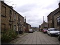
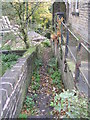
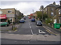
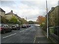
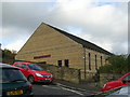
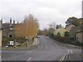
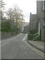
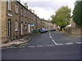
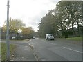

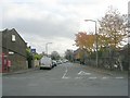
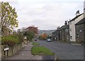
100 photos from this area
Area Information
Key information about the HD4 7HE including its size, population, and administrative classification.
- Area Type
- Postcode
- Area Size
- 1.3 hectares
- Population
- 1583
- Population Density
- 557 people/km²
House Prices in HD4 7HE
37
Properties
£121,235
Average Sold Price
£41,000
Lowest Price
£200,000
Highest Price
Showing 37 properties
| Address | Type | Beds | Baths | Last Sale Price | Last Sale Date | |
|---|---|---|---|---|---|---|
| 97 Beaumont Street, Netherton, Huddersfield, HD4 7HE | Semi-detached | 3 | 1 | £200,000 | Jun 2023 | |
| 73 Beaumont Street, Netherton, Huddersfield, HD4 7HE | Semi-detached | 2 | 1 | £179,500 | Apr 2023 | |
| 81 Beaumont Street, Netherton, Huddersfield, HD4 7HE | Bungalow | - | - | £178,500 | Jun 2022 | |
| 93 Beaumont Street, Netherton, Huddersfield, HD4 7HE | house | 2 | 1 | £192,500 | Mar 2022 | |
| 48 Beaumont Street, Netherton, Huddersfield, HD4 7HE | Detached | 3 | - | £180,000 | Feb 2021 | |
| 57 Beaumont Street, Netherton, Huddersfield, HD4 7HE | Semi-detached | 3 | 1 | £144,000 | Dec 2020 | |
| 71 Beaumont Street, Netherton, Huddersfield, HD4 7HE | Bungalow | - | - | £138,000 | Jun 2020 | |
| 85 Beaumont Street, Netherton, Huddersfield, HD4 7HE | house | - | - | £80,000 | Nov 2019 | |
| 38 Beaumont Street, Netherton, Huddersfield, HD4 7HE | Bungalow | - | - | £132,000 | Dec 2017 | |
| 56 Beaumont Street, Netherton, Huddersfield, HD4 7HE | Bungalow | - | - | £117,500 | Aug 2013 |
Page 1 of 4
Energy Efficiency in HD4 7HE
Amenities
Schools
| Rank | School | Type | Entry gender | Ages |
|---|
Explore more schools in this area
Go to Schools tabDemographics
Household Size
Two person
most common
Accommodation Type
Houses
most common
Tenure
89
majority
Ethnic Group
White
most common
Religion
N/A
most common
Household Composition
N/A
most common
Age
47
median
Adults (30-64 years)
most common
Household Deprivation
N/A
with no deprivation
NS-SEC
42
in Lower managerial occupations
Explore more demographic insights in this area
Go to Demographics tabPlanning
Planning Constraints
- Flood RiskPremium
- Ramsar Wetland SitesPremium
- Area of Outstanding Natural BeautyPremium
- Protected Nature ReservePremium
- Protected WoodlandPremium