Area Overview for HD4 7BX
Photos of HD4 7BX
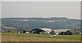
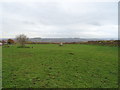

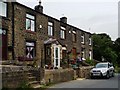
!['Front gardens', Stony Batter [1] in HD4 7BX](https://images.propbar.co.uk/images/geograph/24/81/2481028_120.jpg)

28 photos from this area
Area Information
Key information about the HD4 7BX including its size, population, and administrative classification.
- Area Type
- Postcode
- Area Size
- 59.1 hectares
- Population
- 1583
- Population Density
- 557 people/km²
House Prices in HD4 7BX
12
Properties
£333,667
Average Sold Price
£151,000
Lowest Price
£655,000
Highest Price
Showing 12 properties
| Address | Type | Beds | Baths | Last Sale Price | Last Sale Date | |
|---|---|---|---|---|---|---|
| Greengate Knoll, Sandy Lane, South Crosland, Huddersfield, HD4 7BX | Detached | 5 | 2 | £655,000 | Jun 2025 | |
| 5, Sunnybank, Sandy Lane, South Crosland, Huddersfield, HD4 7BX | Terraced | 2 | 1 | £195,000 | Dec 2024 | |
| 4, Sunnybank, Sandy Lane, South Crosland, Huddersfield, HD4 7BX | house | - | - | £151,000 | Apr 2018 | |
| 3, Sunnybank, Sandy Lane, South Crosland, Huddersfield, HD4 7BX | Cottage | 2 | 1 | - | - | |
| 6, Sunnybank, Sandy Lane, South Crosland, Huddersfield, HD4 7BX | Terraced | 4 | 1 | - | - | |
| 39 Sandy Lane, South Crosland, Huddersfield, HD4 7BX | Detached | 4 | - | - | - | |
| Aerodrome Bungalow, Sandy Lane, South Crosland, Huddersfield, HD4 7BX | Detached | - | - | - | - | |
| Nether Moor Farm, Sandy Lane, South Crosland, Huddersfield, HD4 7BX | Detached | - | - | - | - | |
| Nether Moor House, Nether Moor Farm, Sandy Lane, South Crosland, Huddersfield, HD4 7BX | Detached | - | - | - | - | |
| 1, Sunnybank, Sandy Lane, South Crosland, Huddersfield, HD4 7BX | Terraced | - | - | - | - |
Page 1 of 2
Energy Efficiency in HD4 7BX
Amenities
Schools
| Rank | School | Type | Entry gender | Ages |
|---|
Explore more schools in this area
Go to Schools tabDemographics
Household Size
Two person
most common
Accommodation Type
Houses
most common
Tenure
89
majority
Ethnic Group
White
most common
Religion
N/A
most common
Household Composition
N/A
most common
Age
47
median
Adults (30-64 years)
most common
Household Deprivation
N/A
with no deprivation
NS-SEC
42
in Lower managerial occupations
Explore more demographic insights in this area
Go to Demographics tabPlanning
Planning Constraints
- Flood RiskPremium
- Ramsar Wetland SitesPremium
- Area of Outstanding Natural BeautyPremium
- Protected Nature ReservePremium
- Protected WoodlandPremium