Area Overview for HD4 6XQ
Photos of HD4 6XQ
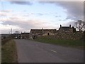
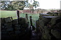
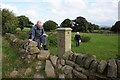
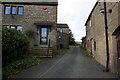
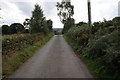
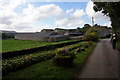
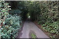
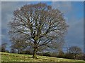
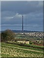
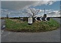
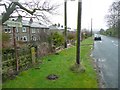
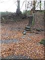
26 photos from this area
Area Information
Key information about the HD4 6XQ including its size, population, and administrative classification.
- Area Type
- Postcode
- Area Size
- 22.5 hectares
- Population
- 1746
- Population Density
- 195 people/km²
House Prices in HD4 6XQ
20
Properties
£297,091
Average Sold Price
£125,000
Lowest Price
£685,000
Highest Price
Showing 20 properties
| Address | Type | Beds | Baths | Last Sale Price | Last Sale Date | |
|---|---|---|---|---|---|---|
| 4 Whitestones, Stocksmoor, Huddersfield, HD4 6XQ | house | - | - | £300,000 | Feb 2023 | |
| 42 Stocks Moor Road, Stocksmoor, Huddersfield, HD4 6XQ | house | - | - | £450,000 | Mar 2019 | |
| 1 Whitestones, Stocksmoor, Huddersfield, HD4 6XQ | Detached | 4 | - | £290,000 | May 2018 | |
| 1A Whitestones, Stocksmoor, Huddersfield, HD4 6XQ | Semi-detached | 3 | - | £245,000 | Apr 2016 | |
| Stathern, 46 Stocks Moor Road, Stocksmoor, Huddersfield, HD4 6XQ | house | - | - | £420,000 | Feb 2012 | |
| Whitestones Barn, Stocks Moor Road, Stocksmoor, Huddersfield, HD4 6XQ | Detached | - | - | £685,000 | Aug 2007 | |
| 28 Stocks Moor Road, Stocksmoor, Huddersfield, HD4 6XQ | Land | - | - | £220,000 | May 2006 | |
| 3 Whitestones, Stocksmoor, Huddersfield, HD4 6XQ | Terraced | - | - | £188,000 | Aug 2003 | |
| 40 Stocks Moor Road, Stocksmoor, Huddersfield, HD4 6XQ | Land | - | - | £195,000 | Sep 2000 | |
| Lane Side, 6-7 Whitestones, Stocksmoor, Huddersfield, HD4 6XQ | Terraced | - | - | £150,000 | Nov 1999 |
Page 1 of 2
Energy Efficiency in HD4 6XQ
Amenities
Schools
| Rank | School | Type | Entry gender | Ages |
|---|
Explore more schools in this area
Go to Schools tabDemographics
Household Size
Two person
most common
Accommodation Type
Houses
most common
Tenure
85
majority
Ethnic Group
White
most common
Religion
N/A
most common
Household Composition
N/A
most common
Age
22
median
Young Adults (15-29 years)
most common
Household Deprivation
N/A
with no deprivation
NS-SEC
30
in Lower managerial occupations
Explore more demographic insights in this area
Go to Demographics tabPlanning
Planning Constraints
- Flood RiskPremium
- Ramsar Wetland SitesPremium
- Area of Outstanding Natural BeautyPremium
- Protected Nature ReservePremium
- Protected WoodlandPremium