Area Overview for HD4 6XD
Photos of HD4 6XD
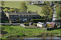
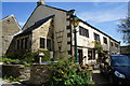
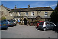
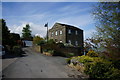
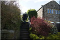
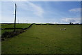
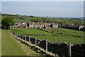
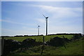
52 photos from this area
Area Information
Key information about the HD4 6XD including its size, population, and administrative classification.
- Area Type
- Postcode
- Area Size
- 19.0 hectares
- Population
- 1746
- Population Density
- 195 people/km²
House Prices in HD4 6XD
15
Properties
£484,400
Average Sold Price
£112,000
Lowest Price
£1,080,000
Highest Price
Showing 15 properties
| Address | Type | Beds | Baths | Last Sale Price | Last Sale Date | |
|---|---|---|---|---|---|---|
| Marsh Croft, 11 Marsh Hall Lane, Thurstonland, Huddersfield, HD4 6XD | house | - | - | £1,080,000 | Jan 2024 | |
| 17 Marsh Hall Lane, Thurstonland, Huddersfield, HD4 6XD | Detached | - | - | £485,000 | Jun 2005 | |
| 15 Marsh Hall Lane, Thurstonland, Huddersfield, HD4 6XD | Detached | - | - | £515,000 | Oct 2004 | |
| 2 Marsh Hall Lane, Thurstonland, Huddersfield, HD4 6XD | Semi-detached | - | - | £112,000 | Jan 2002 | |
| 1, Blake House Farm, Marsh Hall Lane, Thurstonland, Huddersfield, HD4 6XD | Semi-detached | 3 | 2 | £230,000 | Jul 1997 | |
| 4 Marsh Hall Lane, Thurstonland, Huddersfield, HD4 6XD | Semi-detached | 3 | 1 | - | - | |
| Ash Barn, Blake House Farm, Marsh Hall Lane, Thurstonland, Huddersfield, HD4 6XD | Semi-detached | 4 | 2 | - | - | |
| School House, 20 Marsh Hall Lane, Thurstonland, Huddersfield, HD4 6XD | Detached | - | - | - | - | |
| Thurstonland Endowed First School, Marsh Hall Lane, Thurstonland, Huddersfield, HD4 6XD | commercial | - | - | - | - | |
| 6 Marsh Hall Lane, Thurstonland, Huddersfield, HD4 6XD | Semi-detached | - | - | - | - |
Page 1 of 2
Energy Efficiency in HD4 6XD
Amenities
Schools
| Rank | School | Type | Entry gender | Ages |
|---|
Explore more schools in this area
Go to Schools tabDemographics
Household Size
Two person
most common
Accommodation Type
Houses
most common
Tenure
85
majority
Ethnic Group
White
most common
Religion
N/A
most common
Household Composition
N/A
most common
Age
22
median
Young Adults (15-29 years)
most common
Household Deprivation
N/A
with no deprivation
NS-SEC
30
in Lower managerial occupations
Explore more demographic insights in this area
Go to Demographics tabPlanning
Planning Constraints
- Flood RiskPremium
- Ramsar Wetland SitesPremium
- Area of Outstanding Natural BeautyPremium
- Protected Nature ReservePremium