Area Overview for HD4 6TR
Photos of HD4 6TR
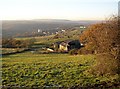
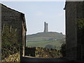
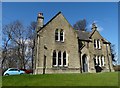
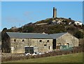
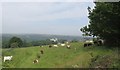
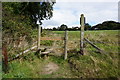
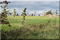
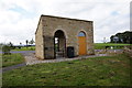
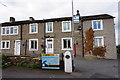
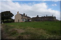
68 photos from this area
Area Information
Key information about the HD4 6TR including its size, population, and administrative classification.
- Area Type
- Postcode
- Area Size
- 23.3 hectares
- Population
- 1484
- Population Density
- 901 people/km²
House Prices in HD4 6TR
9
Properties
£188,667
Average Sold Price
£54,000
Lowest Price
£385,000
Highest Price
Showing 9 properties
| Address | Type | Beds | Baths | Last Sale Price | Last Sale Date | |
|---|---|---|---|---|---|---|
| 9, Lower Park, Park Lane, Berry Brow, Huddersfield, HD4 6TR | Terraced | 2 | 1 | £127,000 | Oct 2017 | |
| 27, Upper Park, Park Lane, Berry Brow, Huddersfield, HD4 6TR | Cottage | 3 | 2 | £385,000 | May 2014 | |
| 7, Lower Park, Park Lane, Berry Brow, Huddersfield, HD4 6TR | Terraced | - | - | £54,000 | Feb 2001 | |
| 15, Lower Park, Park Lane, Berry Brow, Huddersfield, HD4 6TR | Terraced | 3 | 1 | - | - | |
| 11, Lower Park, Park Lane, Berry Brow, Huddersfield, HD4 6TR | Terraced | - | - | - | - | |
| 25, Upper Park, Park Lane, Berry Brow, Huddersfield, HD4 6TR | Detached | - | - | - | - | |
| 13, Lower Park, Park Lane, Berry Brow, Huddersfield, HD4 6TR | house | - | - | - | - | |
| 21, Boggard Ing Farm, Lower Park, Park Lane, Berry Brow, Huddersfield, HD4 6TR | Detached | - | - | - | - | |
| Hayes Partnership, Lower Park Farm, Lower Park, Park Lane, Berry Brow, Huddersfield, HD4 6TR | house | - | - | - | - |
Energy Efficiency in HD4 6TR
Amenities
Schools
| Rank | School | Type | Entry gender | Ages |
|---|
Explore more schools in this area
Go to Schools tabDemographics
Household Size
Two person
most common
Accommodation Type
Houses
most common
Tenure
84
majority
Ethnic Group
White
most common
Religion
N/A
most common
Household Composition
N/A
most common
Age
47
median
Adults (30-64 years)
most common
Household Deprivation
N/A
with no deprivation
NS-SEC
32
in Lower managerial occupations
Explore more demographic insights in this area
Go to Demographics tabPlanning
Planning Constraints
- Flood RiskPremium
- Ramsar Wetland SitesPremium
- Area of Outstanding Natural BeautyPremium
- Protected Nature ReservePremium
- Protected WoodlandPremium