Area Overview for HD4 6NR
Photos of HD4 6NR

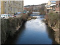
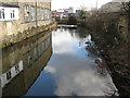
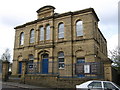
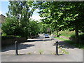
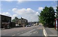
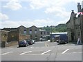
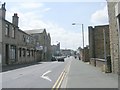
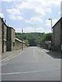
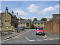
100 photos from this area
Area Information
Key information about the HD4 6NR including its size, population, and administrative classification.
- Area Type
- Postcode
- Area Size
- 6.4 hectares
- Population
- 1752
- Population Density
- 2855 people/km²
House Prices in HD4 6NR
49
Properties
£88,550
Average Sold Price
£65,000
Lowest Price
£128,000
Highest Price
Showing 49 properties
| Address | Type | Beds | Baths | Last Sale Price | Last Sale Date | |
|---|---|---|---|---|---|---|
| 49 Manor Rise, Newsome, Huddersfield, HD4 6NR | Terraced | 2 | 1 | £128,000 | May 2025 | |
| 21 Manor Rise, Newsome, Huddersfield, HD4 6NR | Terraced | 2 | 1 | £113,000 | Feb 2023 | |
| 11 Manor Rise, Newsome, Huddersfield, HD4 6NR | house | 2 | 1 | £125,000 | Oct 2022 | |
| 45 Manor Rise, Newsome, Huddersfield, HD4 6NR | Terraced | 2 | 1 | £72,500 | Sep 2018 | |
| 33 Manor Rise, Newsome, Huddersfield, HD4 6NR | Terraced | 2 | - | £82,000 | May 2018 | |
| 31 Manor Rise, Newsome, Huddersfield, HD4 6NR | Terraced | 2 | 1 | £76,000 | Oct 2017 | |
| 36 Manor Rise, Newsome, Huddersfield, HD4 6NR | Terraced | 2 | - | £79,000 | Jun 2016 | |
| 3 Manor Rise, Newsome, Huddersfield, HD4 6NR | Terraced | 2 | 1 | £75,000 | Jan 2016 | |
| 4 Manor Rise, Newsome, Huddersfield, HD4 6NR | Terraced | 2 | 1 | £70,000 | Jan 2011 | |
| 12 Manor Rise, Newsome, Huddersfield, HD4 6NR | house | - | - | £65,000 | Mar 2005 |
Page 1 of 5
Energy Efficiency in HD4 6NR
Amenities
Schools
| Rank | School | Type | Entry gender | Ages |
|---|
Explore more schools in this area
Go to Schools tabDemographics
Household Size
One person
most common
Accommodation Type
Houses
most common
Tenure
57
majority
Ethnic Group
White
most common
Religion
N/A
most common
Household Composition
N/A
most common
Age
47
median
Adults (30-64 years)
most common
Household Deprivation
N/A
with no deprivation
NS-SEC
26
in Lower managerial occupations
Explore more demographic insights in this area
Go to Demographics tabPlanning
Planning Constraints
- Flood RiskPremium
- Ramsar Wetland SitesPremium
- Area of Outstanding Natural BeautyPremium
- Protected Nature ReservePremium
- Protected WoodlandPremium