Area Overview for HD4 6NB
Photos of HD4 6NB
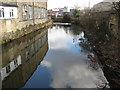
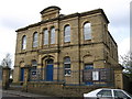
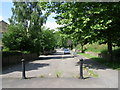
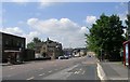
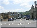
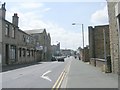
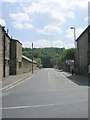
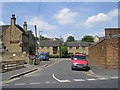
100 photos from this area
Area Information
Key information about the HD4 6NB including its size, population, and administrative classification.
- Area Type
- Postcode
- Area Size
- 4.2 hectares
- Population
- 1664
- Population Density
- 4420 people/km²
House Prices in HD4 6NB
64
Properties
£90,123
Average Sold Price
£15,000
Lowest Price
£190,000
Highest Price
Showing 64 properties
| Address | Type | Beds | Baths | Last Sale Price | Last Sale Date | |
|---|---|---|---|---|---|---|
| 226 Newsome Road, Newsome, Huddersfield, HD4 6NB | Terraced | 3 | 1 | £115,000 | Aug 2025 | |
| 112 Newsome Road, Newsome, Huddersfield, HD4 6NB | Semi-detached | 3 | 1 | £158,000 | May 2025 | |
| 184 Newsome Road, Newsome, Huddersfield, HD4 6NB | Terraced | 1 | 1 | £115,000 | May 2025 | |
| 230 Newsome Road, Newsome, Huddersfield, HD4 6NB | Terraced | 3 | 1 | £115,000 | Mar 2025 | |
| 140 Newsome Road, Newsome, Huddersfield, HD4 6NB | house | 3 | 1 | £190,000 | Feb 2025 | |
| 168 Newsome Road, Newsome, Huddersfield, HD4 6NB | Terraced | 2 | 1 | £130,000 | Dec 2024 | |
| 224 Newsome Road, Newsome, Huddersfield, HD4 6NB | Terraced | 3 | 2 | £125,500 | Oct 2024 | |
| 156 Newsome Road, Newsome, Huddersfield, HD4 6NB | house | - | - | £132,000 | Aug 2024 | |
| 154 Newsome Road, Newsome, Huddersfield, HD4 6NB | house | 3 | 2 | £125,000 | Dec 2023 | |
| 174 Newsome Road, Newsome, Huddersfield, HD4 6NB | Terraced | 2 | 1 | £130,000 | Jun 2023 |
Page 1 of 7
Energy Efficiency in HD4 6NB
Amenities
Schools
| Rank | School | Type | Entry gender | Ages |
|---|
Explore more schools in this area
Go to Schools tabDemographics
Household Size
Two person
most common
Accommodation Type
Houses
most common
Tenure
41
majority
Ethnic Group
White
most common
Religion
N/A
most common
Household Composition
N/A
most common
Age
47
median
Adults (30-64 years)
most common
Household Deprivation
N/A
with no deprivation
NS-SEC
20
in Lower managerial occupations
Explore more demographic insights in this area
Go to Demographics tabPlanning
Planning Constraints
- Flood RiskPremium
- Ramsar Wetland SitesPremium
- Area of Outstanding Natural BeautyPremium
- Protected Nature ReservePremium
- Protected WoodlandPremium