Area Overview for HD4 5YH
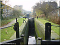
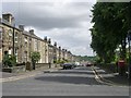
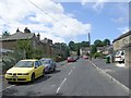
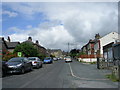
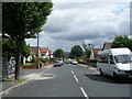
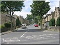
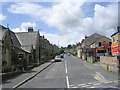
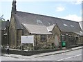
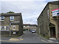
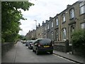
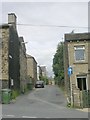
Photos of HD4 5YH

Area Information
HD4 5YH is a small, tightly knit residential postcode in England, home to around 2000 people. It is a quiet, compact area where daily life is shaped by proximity to essential services and a modest, mature community. The area’s character is defined by its limited size, with homes primarily concentrated in a small cluster. Residents benefit from nearby primary schools, retail options, and rail links that connect to larger towns. The population is predominantly adults aged 30–64, suggesting a stable, established community. While the area is not large, its proximity to amenities like Asda Milnsbridge and Huddersfield Railway Station makes it practical for families and commuters. The low flood risk and absence of environmental constraints mean development is not restricted by natural features. However, the medium crime risk score of 46 means residents should take standard security precautions. For those seeking a manageable, low-maintenance area with access to basic services, HD4 5YH offers a straightforward, no-frills living environment.
- Area Type
- Postcode
- Area Size
- Not available
- Population
- 2004
- Population Density
- 5724 people/km²
HD4 5YH is a predominantly owner-occupied area, with 51% of homes owned by residents rather than rented. The accommodation type is primarily houses, which is typical for smaller, residential postcode areas. This suggests a stock of modest, family-friendly properties rather than high-density housing or apartments. The limited size of the area means the housing market is constrained, with few properties available for purchase or rent. For buyers, this could mean competition for a small number of homes, though the lack of environmental constraints or planning restrictions may simplify the process. The presence of nearby rail stations, such as Huddersfield and Berry Brow, could make the area appealing to commuters seeking proximity to larger towns. However, the small population and limited property stock mean the market is unlikely to be dynamic or rapidly expanding.
House Prices in HD4 5YH
No properties found in this postcode.
Energy Efficiency in HD4 5YH
Daily life in HD4 5YH is supported by nearby retail options, including Co-op Crosland, Asda Milnsbridge, and Aldi Golcar, which provide essential shopping and food services. These stores are within practical reach, reducing the need for long journeys to larger centres. The area’s rail stations, such as Huddersfield and Berry Brow, connect residents to broader networks, enabling access to leisure, healthcare, and employment opportunities in nearby towns. While the data does not mention parks or recreational spaces, the absence of environmental constraints suggests open spaces may be available. The compact nature of the area means amenities are concentrated, making it convenient for residents who prefer a self-contained lifestyle. However, those seeking extensive leisure facilities may need to look beyond HD4 5YH.
Amenities
Schools
Residents of HD4 5YH have access to two primary schools within practical reach: Dryclough Church of England Voluntary Controlled Infant School and Moorcross CofE (Controlled) Infant School. Both are primary institutions, catering to younger children and offering a foundation for early education. The presence of two schools in the immediate area provides families with options, though the data does not specify Ofsted ratings or academic performance. The schools’ Church of England affiliation may align with the area’s predominant White ethnic composition and community values. For families with young children, the proximity of these schools reduces commuting time and supports a balanced lifestyle. However, the absence of secondary schools or further education institutions in the data means parents may need to consider nearby towns for older children’s schooling.
| Rank | School | Type | Entry gender | Ages |
|---|
Explore more schools in this area
Go to Schools tabDemographics
The population of HD4 5YH is 2004, with a median age of 47. This indicates a mature demographic, with the majority of residents falling within the 30–64 age range. Home ownership rates stand at 51%, suggesting a mix of owner-occupied properties and rental units. The predominant accommodation type is houses, which aligns with the area’s small, residential nature. The ethnic composition is largely White, though specific data on minority representation is not provided. The age profile suggests a community with a strong presence of working-age adults, possibly with families. With no data on deprivation levels, it is unclear how socioeconomic factors influence quality of life. However, the absence of protected natural areas or planning constraints may contribute to a straightforward living environment, free from restrictions that could complicate housing or development.
Household Size
Accommodation Type
Tenure
Ethnic Group
Religion
Household Composition
Age
Household Deprivation
NS-SEC
Explore more demographic insights in this area
Go to Demographics tabPlanning
Planning Constraints
- Flood RiskPremium
- Ramsar Wetland SitesPremium
- Area of Outstanding Natural BeautyPremium
- Protected Nature ReservePremium
- Protected WoodlandPremium