Area Overview for HD4 5SY
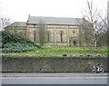
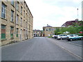
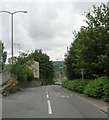
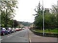
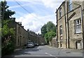
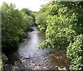
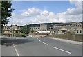
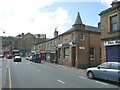
Photos of HD4 5SY


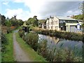
Area Information
HD4 5SY is a small residential postcode area in England, home to 1802 residents. Its compact size fosters a tight-knit community, with daily life centred around practical amenities and local infrastructure. The area is predominantly composed of houses, reflecting a quieter, more settled environment. With a median age of 47, the population skews towards adults aged 30–64, suggesting a mix of established families and professionals. Proximity to Huddersfield Railway Station and nearby retail hubs like Asda Milnsbridge and Aldi Golcar ensures convenience for shopping and commuting. Digital connectivity is strong, with broadband and mobile scores of 83, supporting remote work and seamless internet use. However, the area’s safety profile is mixed: while flood risk is negligible, crime rates are above average, with a safety score of 30. This makes HD4 5SY a practical choice for those prioritising accessibility and affordability, though security considerations are essential.
- Area Type
- Postcode
- Area Size
- Not available
- Population
- 1802
- Population Density
- 2696 people/km²
HD4 5SY’s property market is characterised by a 43% home ownership rate, suggesting a rental-focused market with limited owner-occupied properties. The area’s accommodation is predominantly houses, which is uncommon in smaller postcode areas, hinting at a mix of family homes and larger residences. Given the small size of HD4 5SY, the housing stock is likely limited, with buyers needing to consider nearby areas for more options. The prevalence of houses may appeal to those seeking space, but the rental market’s dominance means competition for buy-to-let properties could be fierce. Prospective buyers should also factor in the area’s safety profile, as high crime rates may influence property values and desirability. The compact nature of the postcode means local amenities are key, with transport links and schools playing a significant role in property appeal.
House Prices in HD4 5SY
No properties found in this postcode.
Energy Efficiency in HD4 5SY
Daily life in HD4 5SY is shaped by its practical amenities, including five retail outlets such as Asda Milnsbridge, Aldi Golcar, and Co-op Leymoor. These stores provide essential shopping options, from groceries to household goods. The area’s rail stations, including Huddersfield Railway Station, offer easy access to broader networks, facilitating both local and long-distance travel. While there is no mention of parks or leisure facilities in the data, the retail and transport options suggest a functional lifestyle focused on convenience. The presence of multiple retail outlets and rail links indicates a community that values accessibility and practicality, though residents may need to venture further for recreational spaces. The mix of shops and transport hubs supports a self-contained yet connected way of living.
Amenities
Schools
The nearest school to HD4 5SY is Crow Lane Primary and Foundation Stage School, a primary school with a Good Ofsted rating. This institution serves the local community, offering education for younger children. The absence of secondary schools in the immediate area means families may need to look further afield for secondary education, though the primary school’s quality is a positive for those prioritising early education. The single school listed suggests a focus on primary needs, which could be a draw for families with young children. However, the lack of secondary options may require careful planning for long-term schooling. The Good rating indicates a reliable educational foundation, though additional research would be needed for secondary schooling.
| Rank | School | Type | Entry gender | Ages |
|---|
Explore more schools in this area
Go to Schools tabDemographics
The population of HD4 5SY has a median age of 47, with the majority of residents aged 30–64. This suggests a community of adults, likely including families and professionals in their prime working years. Home ownership stands at 43%, indicating a rental market dominates, with many residents living in rented houses rather than owner-occupied properties. The predominant ethnic group is White, and the area’s accommodation is largely composed of houses, not flats. There is no data on deprivation levels, but the age profile and housing type imply a stable, mature demographic. The relatively low proportion of homeowners may reflect economic diversity, with some residents opting for rental flexibility. The absence of specific data on diversity metrics means the community’s composition remains broadly defined by the figures provided.
Household Size
Accommodation Type
Tenure
Ethnic Group
Religion
Household Composition
Age
Household Deprivation
NS-SEC
Explore more demographic insights in this area
Go to Demographics tabPlanning
Planning Constraints
- Flood RiskPremium
- Ramsar Wetland SitesPremium
- Area of Outstanding Natural BeautyPremium
- Protected Nature ReservePremium
- Protected WoodlandPremium