Area Overview for HD4 5SG
Photos of HD4 5SG
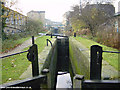
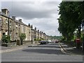
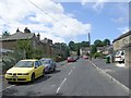
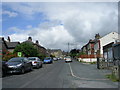

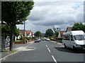
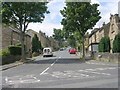
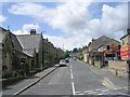

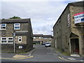
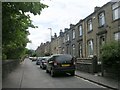
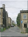
100 photos from this area
Area Information
Key information about the HD4 5SG including its size, population, and administrative classification.
- Area Type
- Postcode
- Area Size
- 8032 m²
- Population
- 1802
- Population Density
- 2696 people/km²
House Prices in HD4 5SG
20
Properties
£70,031
Average Sold Price
£26,000
Lowest Price
£115,000
Highest Price
Showing 20 properties
| Address | Type | Beds | Baths | Last Sale Price | Last Sale Date | |
|---|---|---|---|---|---|---|
| 518 Manchester Road, Milnsbridge, Huddersfield, HD4 5SG | house | - | - | £70,000 | Jan 2025 | |
| 522 Manchester Road, Milnsbridge, Huddersfield, HD4 5SG | house | - | - | £90,000 | May 2024 | |
| 514 Manchester Road, Milnsbridge, Huddersfield, HD4 5SG | Terraced | 2 | 1 | £85,000 | Jan 2024 | |
| 508 Manchester Road, Milnsbridge, Huddersfield, HD4 5SG | Flat | 1 | 1 | £40,000 | Jun 2023 | |
| 528 Manchester Road, Milnsbridge, Huddersfield, HD4 5SG | house | 4 | 2 | £115,000 | Jun 2022 | |
| 494 Manchester Road, Milnsbridge, Huddersfield, HD4 5SG | Terraced | 2 | 1 | £91,000 | May 2022 | |
| 516 Manchester Road, Milnsbridge, Huddersfield, HD4 5SG | Terraced | 3 | 1 | £87,500 | Apr 2022 | |
| 510 Manchester Road, Milnsbridge, Huddersfield, HD4 5SG | Terraced | 3 | 1 | £61,019 | Oct 2019 | |
| 506 Manchester Road, Milnsbridge, Huddersfield, HD4 5SG | Maisonette | 1 | 1 | £33,000 | Sep 2019 | |
| 492 Manchester Road, Milnsbridge, Huddersfield, HD4 5SG | Terraced | 2 | 1 | £80,000 | Jun 2019 |
Page 1 of 2
Energy Efficiency in HD4 5SG
Amenities
Schools
| Rank | School | Type | Entry gender | Ages |
|---|
Explore more schools in this area
Go to Schools tabDemographics
Household Size
One person
most common
Accommodation Type
Houses
most common
Tenure
43
majority
Ethnic Group
White
most common
Religion
N/A
most common
Household Composition
N/A
most common
Age
47
median
Adults (30-64 years)
most common
Household Deprivation
N/A
with no deprivation
NS-SEC
22
in Lower managerial occupations
Explore more demographic insights in this area
Go to Demographics tabPlanning
Planning Constraints
- Flood RiskPremium
- Ramsar Wetland SitesPremium
- Area of Outstanding Natural BeautyPremium
- Protected Nature ReservePremium
- Protected WoodlandPremium