Area Overview for HD4 5HG
Photos of HD4 5HG
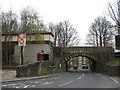
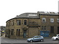
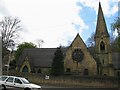
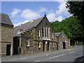
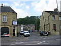
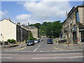
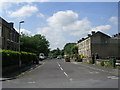
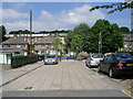
100 photos from this area
Area Information
Key information about the HD4 5HG including its size, population, and administrative classification.
- Area Type
- Postcode
- Area Size
- 1.1 hectares
- Population
- 1987
- Population Density
- 6148 people/km²
House Prices in HD4 5HG
29
Properties
£83,914
Average Sold Price
£21,000
Lowest Price
£169,450
Highest Price
Showing 29 properties
| Address | Type | Beds | Baths | Last Sale Price | Last Sale Date | |
|---|---|---|---|---|---|---|
| 5 Thornfield Avenue, Lockwood, Huddersfield, HD4 5HG | house | - | - | £120,000 | Dec 2025 | |
| 9 Thornfield Avenue, Lockwood, Huddersfield, HD4 5HG | Terraced | 3 | 1 | £169,450 | Jun 2023 | |
| 3 Thornfield Avenue, Lockwood, Huddersfield, HD4 5HG | house | - | - | £115,000 | Oct 2022 | |
| 19 Thornfield Avenue, Lockwood, Huddersfield, HD4 5HG | Semi-detached | 2 | 1 | £85,000 | Sep 2022 | |
| 7 Thornfield Avenue, Lockwood, Huddersfield, HD4 5HG | house | - | - | £142,500 | Nov 2020 | |
| 13 Thornfield Avenue, Lockwood, Huddersfield, HD4 5HG | Terraced | 3 | 1 | £105,750 | Mar 2020 | |
| 25 Thornfield Avenue, Lockwood, Huddersfield, HD4 5HG | house | - | - | £106,000 | Feb 2020 | |
| 12 Thornfield Avenue, Lockwood, Huddersfield, HD4 5HG | Terraced | 3 | 1 | £95,000 | Dec 2019 | |
| 10 Thornfield Avenue, Lockwood, Huddersfield, HD4 5HG | Terraced | 3 | 1 | £114,000 | Apr 2014 | |
| 26 Thornfield Avenue, Lockwood, Huddersfield, HD4 5HG | house | 2 | - | £60,000 | Aug 2011 |
Page 1 of 3
Energy Efficiency in HD4 5HG
Amenities
Schools
| Rank | School | Type | Entry gender | Ages |
|---|
Explore more schools in this area
Go to Schools tabDemographics
Household Size
Family (3-5 people)
most common
Accommodation Type
Houses
most common
Tenure
32
majority
Ethnic Group
White
most common
Religion
N/A
most common
Household Composition
N/A
most common
Age
22
median
Adults (30-64 years)
most common
Household Deprivation
N/A
with no deprivation
NS-SEC
12
in Lower managerial occupations
Explore more demographic insights in this area
Go to Demographics tabPlanning
Planning Constraints
- Flood RiskPremium
- Ramsar Wetland SitesPremium
- Area of Outstanding Natural BeautyPremium
- Protected Nature ReservePremium
- Protected WoodlandPremium