Area Overview for HD4 5BR
Photos of HD4 5BR
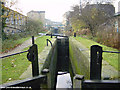
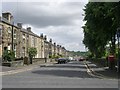
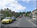
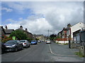

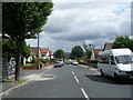

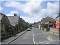

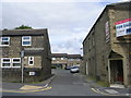
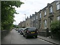
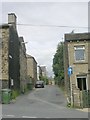
100 photos from this area
Area Information
Key information about the HD4 5BR including its size, population, and administrative classification.
- Area Type
- Postcode
- Area Size
- 2.8 hectares
- Population
- 1686
- Population Density
- 4212 people/km²
House Prices in HD4 5BR
39
Properties
£66,425
Average Sold Price
£18,200
Lowest Price
£170,000
Highest Price
Showing 39 properties
| Address | Type | Beds | Baths | Last Sale Price | Last Sale Date | |
|---|---|---|---|---|---|---|
| 403 Manchester Road, Crosland Moor, Huddersfield, HD4 5BR | Terraced | 2 | 1 | £116,000 | Sep 2025 | |
| 381 Manchester Road, Crosland Moor, Huddersfield, HD4 5BR | Terraced | 3 | 1 | £95,000 | Sep 2024 | |
| 409 Manchester Road, Crosland Moor, Huddersfield, HD4 5BR | Terraced | 5 | 2 | £170,000 | Jun 2023 | |
| 415 Manchester Road, Crosland Moor, Huddersfield, HD4 5BR | Terraced | 4 | 1 | £80,000 | Nov 2021 | |
| 423 Manchester Road, Crosland Moor, Huddersfield, HD4 5BR | Terraced | 3 | 1 | £66,000 | Aug 2021 | |
| 419 Manchester Road, Crosland Moor, Huddersfield, HD4 5BR | house | - | - | £64,000 | Jun 2021 | |
| 401 Manchester Road, Crosland Moor, Huddersfield, HD4 5BR | Terraced | 3 | - | £52,000 | Dec 2019 | |
| 413 Manchester Road, Crosland Moor, Huddersfield, HD4 5BR | Terraced | 3 | 1 | £47,000 | Dec 2019 | |
| 387 Manchester Road, Crosland Moor, Huddersfield, HD4 5BR | house | - | - | £88,950 | Apr 2019 | |
| 389 Manchester Road, Crosland Moor, Huddersfield, HD4 5BR | Terraced | - | - | £37,500 | Nov 2018 |
Page 1 of 4
Energy Efficiency in HD4 5BR
Amenities
Schools
| Rank | School | Type | Entry gender | Ages |
|---|
Explore more schools in this area
Go to Schools tabDemographics
Household Size
One person
most common
Accommodation Type
Houses
most common
Tenure
55
majority
Ethnic Group
White
most common
Religion
N/A
most common
Household Composition
N/A
most common
Age
47
median
Adults (30-64 years)
most common
Household Deprivation
N/A
with no deprivation
NS-SEC
16
in Lower managerial occupations
Explore more demographic insights in this area
Go to Demographics tabPlanning
Planning Constraints
- Flood RiskPremium
- Ramsar Wetland SitesPremium
- Area of Outstanding Natural BeautyPremium
- Protected Nature ReservePremium
- Protected WoodlandPremium