Area Overview for HD3 4AW
Photos of HD3 4AW
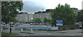
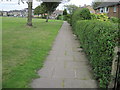
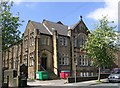
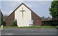
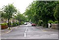
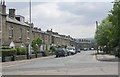
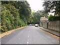
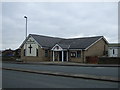
100 photos from this area
Area Information
Key information about the HD3 4AW including its size, population, and administrative classification.
- Area Type
- Postcode
- Area Size
- 4603 m²
- Population
- 1814
- Population Density
- 6741 people/km²
House Prices in HD3 4AW
12
Properties
£123,751
Average Sold Price
£40,500
Lowest Price
£185,000
Highest Price
Showing 12 properties
| Address | Type | Beds | Baths | Last Sale Price | Last Sale Date | |
|---|---|---|---|---|---|---|
| 7 Hollin Avenue, Marsh, Huddersfield, HD3 4AW | Terraced | 3 | 1 | £185,000 | Oct 2024 | |
| 9 Hollin Avenue, Marsh, Huddersfield, HD3 4AW | Terraced | 3 | 1 | £165,005 | Mar 2019 | |
| 1 Hollin Avenue, Marsh, Huddersfield, HD3 4AW | Terraced | 3 | 1 | £118,000 | Nov 2018 | |
| 5 Hollin Avenue, Marsh, Huddersfield, HD3 4AW | Terraced | 3 | 2 | £115,000 | Mar 2016 | |
| 2 Hollin Avenue, Marsh, Huddersfield, HD3 4AW | house | - | - | £119,000 | Feb 2011 | |
| 10 Hollin Avenue, Marsh, Huddersfield, HD3 4AW | Terraced | 3 | - | £40,500 | Jan 2003 | |
| First Floor Flat, 5 Hollin Avenue, Marsh, Huddersfield, HD3 4AW | Flat | - | - | - | - | |
| Ground Floor Flat, 5 Hollin Avenue, Marsh, Huddersfield, HD3 4AW | Flat | - | - | - | - | |
| 6 Hollin Avenue, Marsh, Huddersfield, HD3 4AW | Terraced | - | - | - | - | |
| 3 Hollin Avenue, Marsh, Huddersfield, HD3 4AW | Terraced | - | - | - | - |
Page 1 of 2
Energy Efficiency in HD3 4AW
Amenities
Schools
| Rank | School | Type | Entry gender | Ages |
|---|
Explore more schools in this area
Go to Schools tabDemographics
Household Size
One person
most common
Accommodation Type
Houses
most common
Tenure
58
majority
Ethnic Group
White
most common
Religion
N/A
most common
Household Composition
N/A
most common
Age
47
median
Adults (30-64 years)
most common
Household Deprivation
N/A
with no deprivation
NS-SEC
30
in Lower managerial occupations
Explore more demographic insights in this area
Go to Demographics tabPlanning
Planning Constraints
- Flood RiskPremium
- Ramsar Wetland SitesPremium
- Area of Outstanding Natural BeautyPremium
- Protected Nature ReservePremium
- Protected WoodlandPremium