Area Overview for HD2 2LR
Photos of HD2 2LR
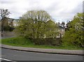
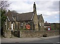
100 photos from this area
Area Information
Key information about the HD2 2LR including its size, population, and administrative classification.
- Area Type
- Postcode
- Area Size
- 6.1 hectares
- Population
- 1806
- Population Density
- 3278 people/km²
House Prices in HD2 2LR
61
Properties
£213,198
Average Sold Price
£62,000
Lowest Price
£359,000
Highest Price
Showing 61 properties
| Address | Type | Beds | Baths | Last Sale Price | Last Sale Date | |
|---|---|---|---|---|---|---|
| 6 Netherwood Close, Fixby, Huddersfield, HD2 2LR | Bungalow | 2 | 1 | £172,000 | Aug 2024 | |
| 14 Netherwood Close, Fixby, Huddersfield, HD2 2LR | Bungalow | 2 | 1 | £219,000 | Dec 2023 | |
| 36 Netherwood Close, Fixby, Huddersfield, HD2 2LR | Bungalow | 4 | 2 | £330,000 | May 2023 | |
| 34 Netherwood Close, Fixby, Huddersfield, HD2 2LR | Retail | 3 | 1 | £300,000 | Dec 2021 | |
| 44 Netherwood Close, Fixby, Huddersfield, HD2 2LR | house | - | - | £240,000 | Sep 2021 | |
| 22 Netherwood Close, Fixby, Huddersfield, HD2 2LR | Bungalow | - | - | £270,000 | Aug 2021 | |
| 40 Netherwood Close, Fixby, Huddersfield, HD2 2LR | house | - | - | £253,000 | Dec 2020 | |
| 2 Netherwood Close, Fixby, Huddersfield, HD2 2LR | Bungalow | 2 | 1 | £186,500 | Oct 2020 | |
| 16 Netherwood Close, Fixby, Huddersfield, HD2 2LR | Bungalow | - | - | £225,000 | Dec 2019 | |
| 32 Netherwood Close, Fixby, Huddersfield, HD2 2LR | Bungalow | - | - | £359,000 | Sep 2019 |
Page 1 of 7
Energy Efficiency in HD2 2LR
Amenities
Schools
| Rank | School | Type | Entry gender | Ages |
|---|
Explore more schools in this area
Go to Schools tabDemographics
Household Size
Family (3-5 people)
most common
Accommodation Type
Houses
most common
Tenure
73
majority
Ethnic Group
asian_total
most common
Religion
N/A
most common
Household Composition
N/A
most common
Age
47
median
Adults (30-64 years)
most common
Household Deprivation
N/A
with no deprivation
NS-SEC
23
in Lower managerial occupations
Explore more demographic insights in this area
Go to Demographics tabPlanning
Planning Constraints
- Flood RiskPremium
- Ramsar Wetland SitesPremium
- Area of Outstanding Natural BeautyPremium
- Protected Nature ReservePremium
- Protected WoodlandPremium