Area Overview for HD2 2HS
Photos of HD2 2HS
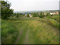
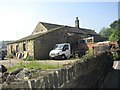
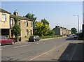
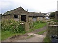
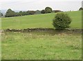
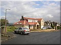
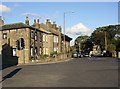
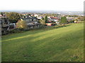
100 photos from this area
Area Information
Key information about the HD2 2HS including its size, population, and administrative classification.
- Area Type
- Postcode
- Area Size
- 2.1 hectares
- Population
- 1401
- Population Density
- 1195 people/km²
House Prices in HD2 2HS
30
Properties
£303,039
Average Sold Price
£105,000
Lowest Price
£435,000
Highest Price
Showing 30 properties
| Address | Type | Beds | Baths | Last Sale Price | Last Sale Date | |
|---|---|---|---|---|---|---|
| Stoneleigh, 68A Lightridge Road, Fixby, Huddersfield, HD2 2HS | Detached | 5 | 2 | £435,000 | Jul 2025 | |
| 74 Lightridge Road, Fixby, Huddersfield, HD2 2HS | Detached | 4 | 2 | £390,000 | Jun 2025 | |
| 76 Lightridge Road, Fixby, Huddersfield, HD2 2HS | house | - | - | £354,000 | Jun 2024 | |
| 169 Lightridge Road, Fixby, Huddersfield, HD2 2HS | Detached | 4 | 1 | £385,000 | Jul 2023 | |
| 72 Lightridge Road, Fixby, Huddersfield, HD2 2HS | Detached | 3 | 2 | £378,000 | Nov 2022 | |
| 159 Lightridge Road, Fixby, Huddersfield, HD2 2HS | house | - | - | £370,000 | Apr 2022 | |
| 78 Lightridge Road, Fixby, Huddersfield, HD2 2HS | house | - | - | £425,000 | Jun 2021 | |
| 155 Lightridge Road, Fixby, Huddersfield, HD2 2HS | house | 3 | 2 | £377,500 | May 2021 | |
| 161 Lightridge Road, Fixby, Huddersfield, HD2 2HS | house | - | - | £285,000 | Oct 2019 | |
| 165 Lightridge Road, Fixby, Huddersfield, HD2 2HS | house | - | - | £345,000 | Jul 2017 |
Page 1 of 3
Energy Efficiency in HD2 2HS
Amenities
Schools
| Rank | School | Type | Entry gender | Ages |
|---|
Explore more schools in this area
Go to Schools tabDemographics
Household Size
Family (3-5 people)
most common
Accommodation Type
Houses
most common
Tenure
95
majority
Ethnic Group
White
most common
Religion
N/A
most common
Household Composition
N/A
most common
Age
47
median
Adults (30-64 years)
most common
Household Deprivation
N/A
with no deprivation
NS-SEC
47
in Lower managerial occupations
Explore more demographic insights in this area
Go to Demographics tabPlanning
Planning Constraints
- Flood RiskPremium
- Ramsar Wetland SitesPremium
- Area of Outstanding Natural BeautyPremium
- Protected Nature ReservePremium
- Protected WoodlandPremium