Area Overview for HD2 2FF
Photos of HD2 2FF

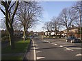
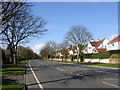
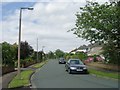
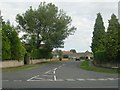
100 photos from this area
Area Information
Key information about the HD2 2FF including its size, population, and administrative classification.
- Area Type
- Postcode
- Area Size
- 2.2 hectares
- Population
- 1401
- Population Density
- 1195 people/km²
House Prices in HD2 2FF
19
Properties
£279,783
Average Sold Price
£89,950
Lowest Price
£415,000
Highest Price
Showing 19 properties
| Address | Type | Beds | Baths | Last Sale Price | Last Sale Date | |
|---|---|---|---|---|---|---|
| 8 Beechwood Grove, Fixby, Huddersfield, HD2 2FF | house | 4 | 2 | £415,000 | Nov 2024 | |
| 6 Beechwood Grove, Fixby, Huddersfield, HD2 2FF | house | - | - | £362,000 | Dec 2023 | |
| 15 Beechwood Grove, Fixby, Huddersfield, HD2 2FF | house | - | - | £390,000 | May 2022 | |
| 5 Beechwood Grove, Fixby, Huddersfield, HD2 2FF | Detached | 4 | 3 | £275,000 | Feb 2020 | |
| 11 Beechwood Grove, Fixby, Huddersfield, HD2 2FF | house | - | - | £318,000 | Oct 2019 | |
| 19 Beechwood Grove, Fixby, Huddersfield, HD2 2FF | Bungalow | - | - | £367,000 | Jul 2018 | |
| 3 Beechwood Grove, Fixby, Huddersfield, HD2 2FF | Detached | 4 | 1 | £277,000 | Mar 2018 | |
| 9 Beechwood Grove, Fixby, Huddersfield, HD2 2FF | Bungalow | 2 | 1 | £200,000 | Nov 2016 | |
| 7 Beechwood Grove, Fixby, Huddersfield, HD2 2FF | Detached | 5 | - | £327,500 | Jul 2009 | |
| 2 Beechwood Grove, Fixby, Huddersfield, HD2 2FF | house | - | - | £202,000 | Jun 2005 |
Page 1 of 2
Energy Efficiency in HD2 2FF
Amenities
Schools
| Rank | School | Type | Entry gender | Ages |
|---|
Explore more schools in this area
Go to Schools tabDemographics
Household Size
Family (3-5 people)
most common
Accommodation Type
Houses
most common
Tenure
95
majority
Ethnic Group
White
most common
Religion
N/A
most common
Household Composition
N/A
most common
Age
47
median
Adults (30-64 years)
most common
Household Deprivation
N/A
with no deprivation
NS-SEC
47
in Lower managerial occupations
Explore more demographic insights in this area
Go to Demographics tabPlanning
Planning Constraints
- Flood RiskPremium
- Ramsar Wetland SitesPremium
- Area of Outstanding Natural BeautyPremium
- Protected Nature ReservePremium
- Protected WoodlandPremium